Kwaay Paay Peak Trail in San Diego’s Mission Trails Regional Park
Discover a hidden treasure for hiking enthusiasts in the heart of San Diego – Mission Trails Regional Park. This expansive natural haven offers a variety of captivating trails, each with its unique charm. Among these trails, the Kwaay Paay Peak Trail stands out as an adventure that will inspire you.
RELATED: Kwaay Paay Peak Hike from the Old Dam Trailhead
Trailhead Information and Facilities
Situated in the picturesque expanse of the park, Kwaay Paay Peak Trail is just a short distance from downtown. The trailhead is easily accessible, making it a perfect choice for locals and visitors alike. No permits or passes are required, ensuring a hassle-free hiking experience. The trailhead area provides essential facilities, including restrooms, to ensure your comfort before you embark on your expedition.
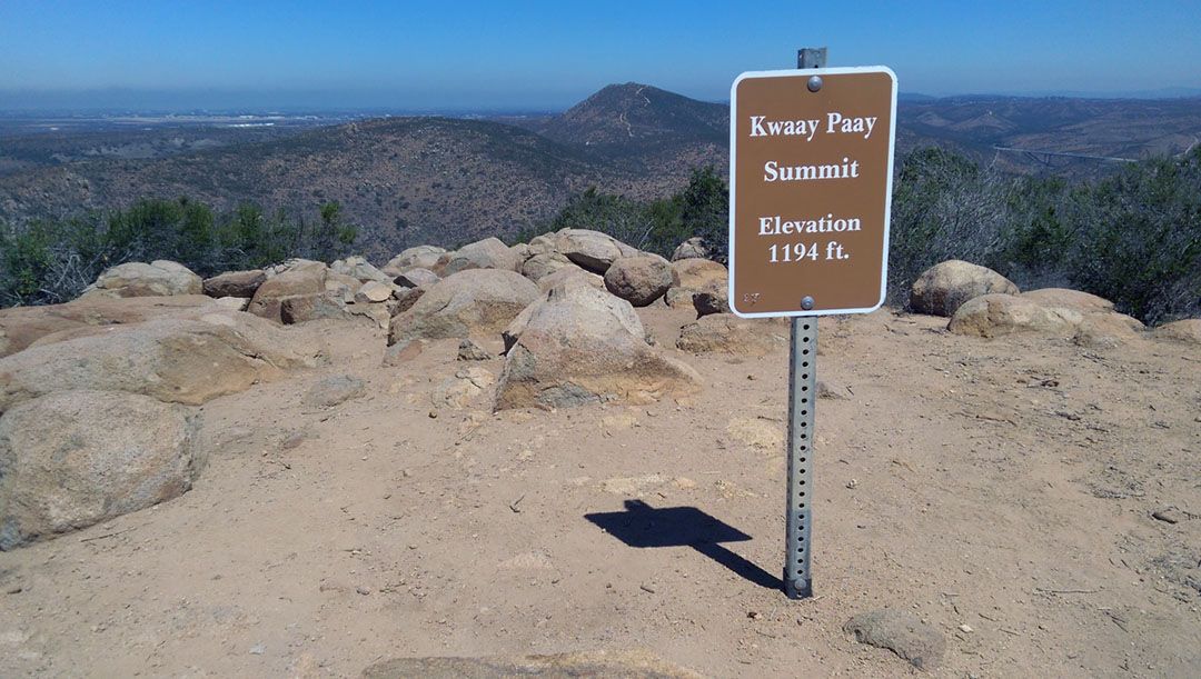
About Kwaay Paay Peak Trail
With a moderate difficulty level, this 2.5-mile round-trip hike offers an enjoyable challenge without being overly strenuous. The trail’s rugged terrain adds an adventurous touch as you ascend to a peak elevation of 1,194 feet.
Hiking Kwaay Paay Peak Trail
From the summit of Kwaay Paay, you will enjoy a panoramic view of the county from the Pacific Ocean to the Mountains. This visual feast adds a dash of magic to your outdoor adventure. While it is a challenging hike, it’s perfect for hikers of all levels and will provide an adventure that the whole family can enjoy.
This adventure will guide you through changing landscapes, with sweeping views of San Diego’s eastern mountains accompanying your ascent toward Kwaay Paay Peak’s summit. Once you reach the top, the county’s panorama unfurls – from the serene Pacific Ocean to the towering Mountains. Nature’s enchanting display infuses your outdoor escapade with wonder. The trail is an ideal playground for hikers and runners alike, welcoming all levels.
What to Expect on Kwaay Paay Peak Trail
Tackle this trail from late fall through spring when the weather is most favorable. Wear sturdy hiking shoes that can handle the rugged terrain, and remember to pack essentials like sunscreen and sufficient water. While the trail allows leashed dogs, make sure your furry friend is up for the challenge too.
When to Go
- Fall
- Spring
- Summer
- Winter
What to Bring & Wear
- At least one liter of water
- Hiking shoes or boots with plenty of traction
- Sunscreen & hat