South Fortuna Peak via South Fortuna Mountain Trail
Mission Trails Regional Park is located in the heart of San Diego, California, and offers a haven for outdoor enthusiasts seeking a diverse range of hiking experiences. One of the standout hikes within this expansive park is the hike to South Fortuna Peak via South Fortuna Mountain Trail. This hike is known for its iconic wooden stairs leading to the summit and boasts captivating scenery and delightful challenges.
RELATED: South Fortuna Trail to North Fortuna via Visitors Center Loop Trailhead
Trailhead Information and Facilities
Accessing the South Fortuna Mountain Trail at Mission Trails Regional Park is effortless. There’s ample parking available near the trailhead, ensuring a convenient start to your adventure. No permits or passes are required, making it an accessible choice for spontaneous hikers. While the trailhead itself lacks facilities, you’ll find convenient amenities at the nearby Visitors Center.
About South Fortuna Mountain Trail
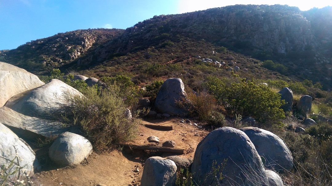
This trail offers a microcosm of San Diego’s natural beauty, showcasing various topographies, from rolling hills to shaded canyons. Towering chaparral and the fragrant coastal sagebrush enhance the sensory experience. The South Fortuna Mountain Trail promises a memorable trek for seasoned hikers yet remains approachable for those seeking a rewarding challenge. Covering a round trip distance of 4.5 miles with an elevation gain of 1,400 feet, it’s an adventure you can complete in approximately three hours. Plus, it’s a dog-friendly path, so don’t hesitate to bring your four-legged hiking buddy along.
Hiking South Fortuna Mountain Trail
Embarking on the South Fortuna Mountain Trail, you’ll find yourself immersed in nature’s grandeur. Follow the well-marked path as it winds through chaparral-covered slopes and alongside enchanting streams. Keep an eye out for trail markers to ensure you stay on course. As you ascend, you’ll encounter the famous wooden stairs leading to South Fortuna Peak.
What to Expect on South Fortuna Mountain Trail
The South Fortuna Mountain Trail treats hikers to a medley of terrains, ranging from packed earth to rocky outcrops. Sturdy footwear is essential to navigate these diverse surfaces. Remember to pack essentials like sunscreen and water to stay comfortable and protected. The trail also offers panoramic views of San Diego County, including glimpses of the local mountains, so keep your camera handy. Keep an eye out for local wildlife and plant species along the way.
South Fortuna Mountain Trail is an inviting challenge for hikers of all levels. From its unique wooden stairs to its sweeping views, this trail encapsulates the essence of Mission Trails Regional Park.
When to Go
- Fall
- Spring
- Summer
- Winter
What to Bring & Wear
- At least two liters of water
- Hiking shoes or boots with plenty of traction
- Sunscreen & hat