Pyles Peak via Golfcrest Drive Trailhead in Mission Trails
San Diego is a treasure trove for outdoor enthusiasts, boasting a variety of hiking trails with breathtaking views. Among these hidden gems lies Pyles Peak, a lesser-known destination near Cowles Mountain trail. Nestled within Mission Trails Regional Park, this 3-mile out-and-back extension promises a serene escape from the crowds of Cowles Mountain.
RELATED: Kwaay Paay Peak Hike from the Old Dam Trailhead
Trailhead Information and Facilities
Accessible via the Golfcrest Drive trailhead, reaching Pyles Peak is a breeze. Ample parking is available, ensuring a hassle-free start to your adventure. No permits or entry fees are required, making it an accessible option for everyone. Facilities at the trailhead offer a convenient pitstop before you embark on your journey.
About Pyles Peak
Though overshadowed in stature by its 1,593-foot neighbor Cowles Mountain, the summit stands tall at 1,379 feet and has its own unique appeal. The hike to Pyles will add about three miles and one hour to your hike for a total of about 3 hours. It’s worth noting that while the trail is open to hikers of different fitness levels, its steep inclines and lack of shade make it better suited for those seeking a more challenging trek. Don’t forget to leash up your furry companions – dogs are welcome here!
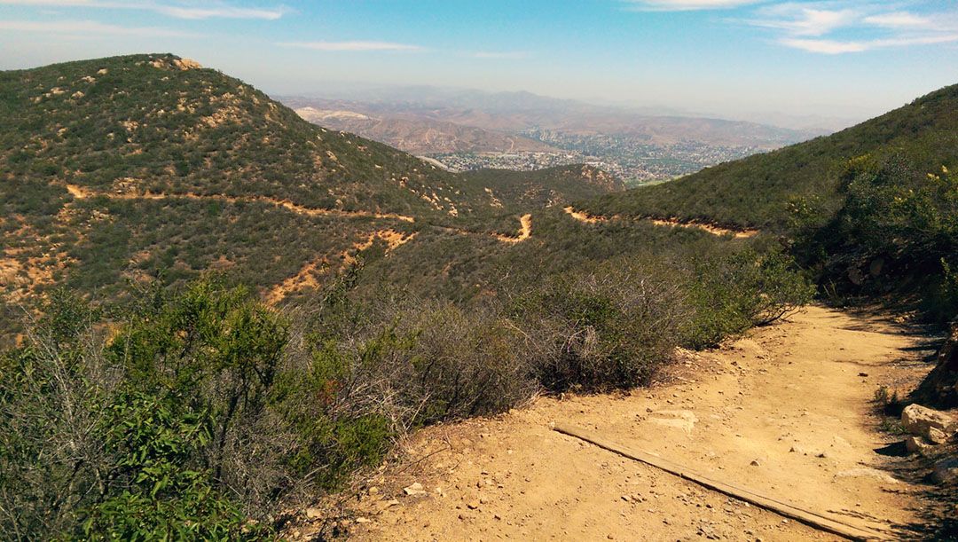
Hiking Pyles Peak
Embarking on your Pyles Peak adventure is a straightforward affair. From the Golfcrest Drive trailhead, follow the well-traveled trail that winds through the picturesque landscape. Once you reach the summit of Cowles Mountain, look to the west for the sign leading to the trailhead just a few feet away. Follow the main trail until you see a trail marker pointing you toward the summit.
What to Expect on the Trail
Pyles Peak offers a blend of challenges and rewards. The terrain varies from rocky stretches to more even ground, so sturdy footwear is recommended. Very little shade is available on the trail, so stay hydrated and wear sunscreen, especially during the warmer months. Keep your eyes peeled for local wildlife and take in the breathtaking views of San Diego County.
Remember, this is a year-round adventure, but for a more comfortable experience, aim to hit the trail in the early morning to beat the midday heat.
Hiking to Pyles Peak via the Golfcrest Drive trailhead offers a refreshing addition to the shorter and more crowded Cowles Mountain trail. With its unique charm and stunning views, Pyles Peak is a must-visit for hikers seeking a little tranquility in the heart of San Diego.
When to Go
- Fall
- Spring
- Summer
- Winter
What to Bring & Wear
- At least two liters of water
- Hiking shoes or boots with plenty of traction
- Sunscreen & hat