Bell Bluff Trail: Adventures in Off-trail Bushwhacking and Scrambling
Most of the trails I’ve hit recently, including Middle Peak, Pine Mountain, Lawson, and Gaskill Peak, have all tested me in ways I had never expected. Bell Bluff trail is just the latest hike to offer up a challenge. With bushwhacking, route finding, and rock scrambling, this hike delivers adventure at every turn.
RELATED: Bell Bluff Trail in Alpine, San Diego
Bell Bluff Trail
Located in Alpine, CA, Bell Bluff is just one of several prominent peaks in the area. The hike starts at an unassuming trailhead hidden on a quiet neighborhood street. Upon our arrival at the trailhead, we parked off the street before starting our hike.
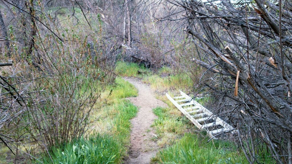
Once past the trailhead gate, the trail takes you down between private properties towards the Sweetwater River, which was dry when we hiked this trail in late February. There is a ladder to help you cross when the water is flowing, but it’s good to prepare to get a little wet.
After crossing the river, the trail begins climbing slowly up and out of the valley before turning due east at about 1.2 miles in. We started this hike at 6:30 am, and even with sunglasses, the early morning sun was blinding. It was difficult to see the trail ocassionally without holding my hand up to block the sun.
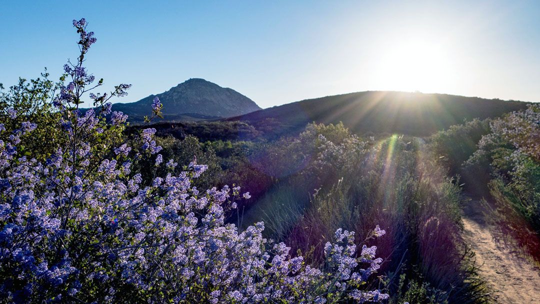
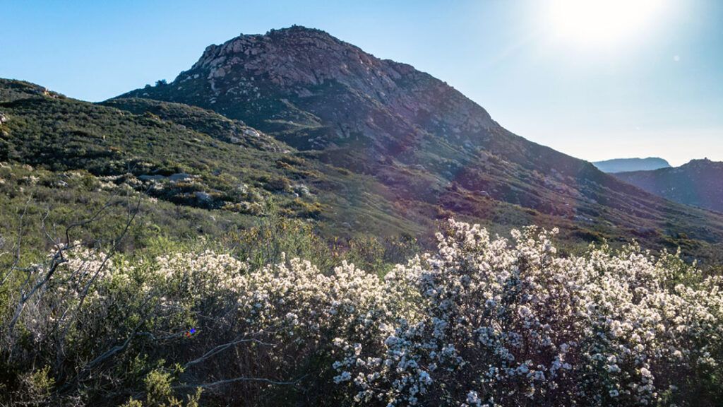
Spring has come early this year, so our hike to the summit of Bell Bluff was full of fresh blooms of wildflowers. Fields of purple California lilac were the most prominent flowers we passed. We also came across bright yellow daisies, wild mustard blooms, and patches of white California buckwheat, and the sweet smell of California sage scrub was everywhere.
The Route to the Summit of Bell Bluff
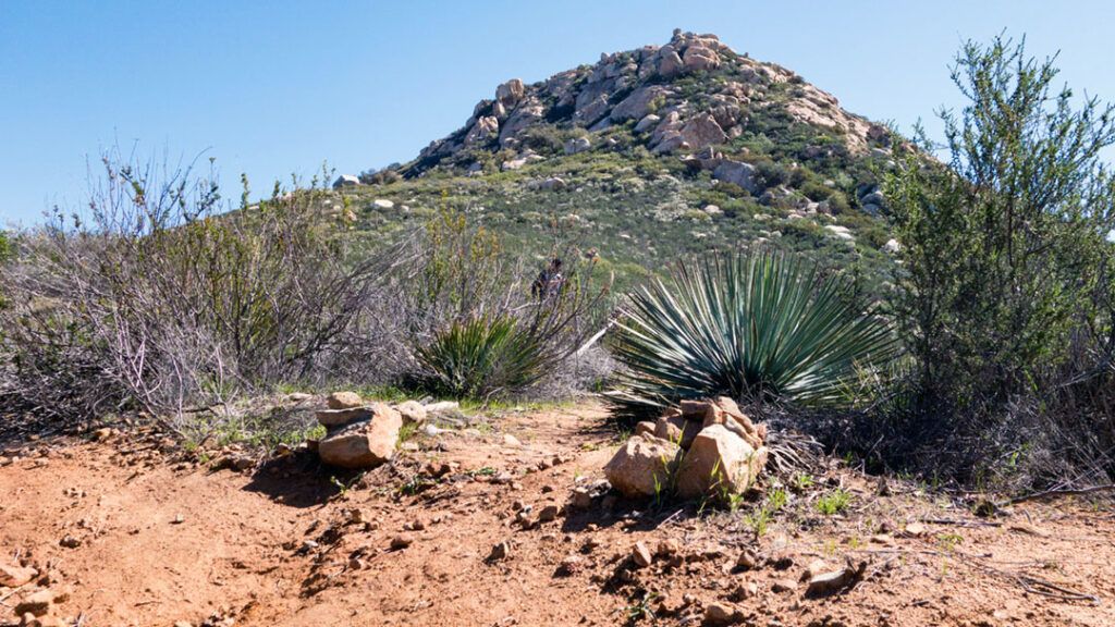
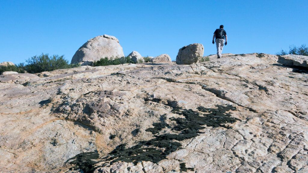
Approximately 3 miles into the hike we reached the base of Bell Bluff. A small cairn-marked trail went off to the right towards the peak. Leaving the main trail behind, we hiked in about 50 feet or so to a clearing where we stopped briefly to figure out our plan for getting to the summit.
The granite peak is intimidating from a distance, but when you’re standing directly beneath it, the challenge that awaits becomes clear. Steep granite slabs and large boulders surrounded by manzanita trees, yucca trees, and other hardy plants covered the hillside.
As we wandered around the clearing looking for the easiest approach, we were surprised to find a light trail leading off into the bushes.
It’s a Scramble
Everything I had read about the hike described difficult bushwhacking and a scramble up the hill to the summit. I wore long pants and gloves to prepare for it. The hike has become more popular since those articles were written, and you can now follow a faint trail up the western face to the summit.
We began the ascent through the bushes, easily maneuvering around trees, brush, and boulders. Although the climb was steady, it was manageable, and we rarely needed to use our hands. Sometimes, we lost sight of the trail as we walked over boulders, but we always managed to find it again a few yards later, usually because we spotted a cairn.
After scrambling for about one-third of a mile, we arrived at a large granite slab, a great spot to take a break and enjoy the view. From there, we saw what we believed was the summit. The scramble ahead looked more challenging than the one we had just completed, but fortunately, we found the trail again, leading us upward.
We Made It!
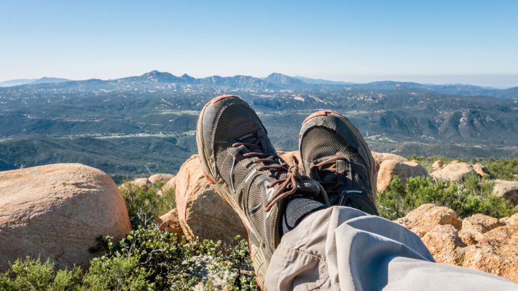
We finally reached the top after a quarter-mile and a couple of false summits. On top, we discovered three geological survey markers, a summit register, and 360-degree views. We could identify Cuyamaca Peak to the northeast, Lawson and Gaskill Peaks to the south, and El Cajon Mountain to the northwest. Although it was hazy, we could see Downtown San Diego to the immediate west.
The bushwhacking and scrambling were much less demanding than we had anticipated. The trail cleared by previous hikers was easy to follow and extremely helpful. They had taken the time to clear a path through the bushes, making the summit more accessible than ever.
Conclusion
Bell Bluff offers a unique hiking experience that will challenge even the most seasoned hikers. While the trail is not as well-marked as other peaks in the area, the bushwhacking and scrambling provide a sense of adventure that is hard to find elsewhere. The views from the top are breathtaking, and the opportunity to explore a less-visited peak is a bonus. Bell Bluff is an excellent choice for hikers looking to challenge themselves while enjoying the natural beauty of San Diego.
Tips
- Wear long pants, good hiking shoes, and gloves for the scramble
- Bring sunglasses and sunscreen
- Carry a minimum of two liters of water, three during warmer months
- There’s very little shade, so avoid this trail during summer and early fall
It will be great to have your route map for this hike…
Hi AkiraDay,
Thanks for stopping by. Here are links to my:
GPS Track (.gpx) – http://getgooutdoors.com/gps-tracks/bell-bluff.gpx
Google Earth Track (.kmz) – http://getgooutdoors.com/gps-tracks/bell-bluff.kmz
Enjoy the hike!
Robb