Gaskill Peak: Off-trail Adventures in San Diego’s Backcountry
Gaskill Peak and Lawson Peak are known for their challenging ascents and rewarding views. They share much of the same hiking trails and scenery, so I’m picking this trail report up where my report on Lawson Peak ended. Also, if you haven’t read that report yet, be sure to check it out for a description of the hike to Wisecarver Road from the trailhead at Lyons Valley Road.
RELATED: Gaskill Peak via Lawson Peak Trail in Cleveland National Forest
Hiking from Wisecarver Road to Gaskill Peak
Continue following Wisecarver Road for another 1.5 miles towards Gaskill Peak from the base of Lawson Peak. Until you reach the base of Gaskill Peak, you’ll only experience a minimal amount of elevation change.
At the base of the peak, the trail takes a sharp to the right (southeast). Following the turn, the trail opens up slightly to an intersection of trails.
A well-worn trail breaks off from the intersection that leads to a southeast-facing scenic overlook with views of the valley. While Wisecarver Road continues north around and over the mountain straight ahead.
Finding Gaskill Peak Trail
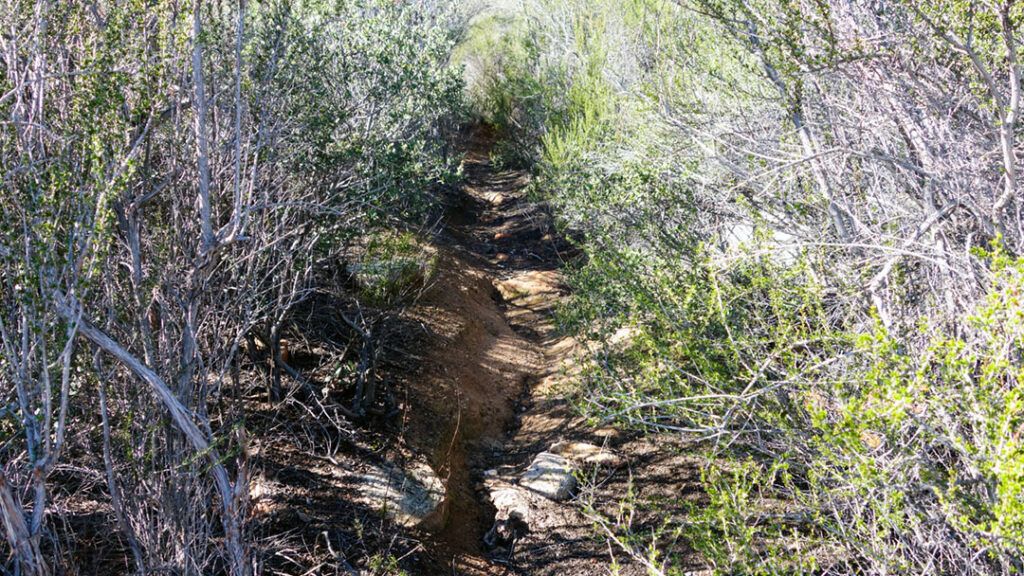
To summit Gaskill Peak, take the lightly traveled trail heading into the bushes to the north. Continue along this trail for a short distance while watching for signs of an even more primitive trail that shoots off to the left directly into the underbrush.
The summit trail lacks fixed signs or markers, so it is easy to miss if you are not paying attention. But if you’re lucky, as I was on my second visit, you may find that the trail is marked with cairns by past visitors.
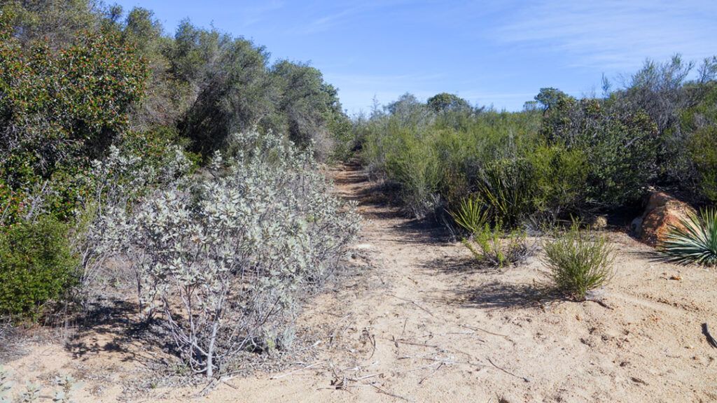
There are no fixed signs or trail markers for the summit trail, and it’s very easy to miss if you’re not paying attention. If you’re lucky, as I was on my second visit, you may find that the trail is marked with cairns by past visitors.
In any case, if you find that you’ve gone more than a couple of hundred yards without running into the trail, you probably walked right by it. Turn around and head back rather than making the mistake I made the first time by continuing my search for a 1/2 mile or more.
If you’ve gone more than a couple of hundred yards without finding the trail, you probably already passed it. Turn around and head back, rather than making the same mistake I did the first time by continuing my search for half a mile or more.
The Final Push
When you locate the trail, plunge yourself into the brush and work your way up the mountain toward the peak. When you get to the top, you’ll have several options for climbing up. After a little hunting. I found a route that worked for me by heading westward around the south edge of the peak.
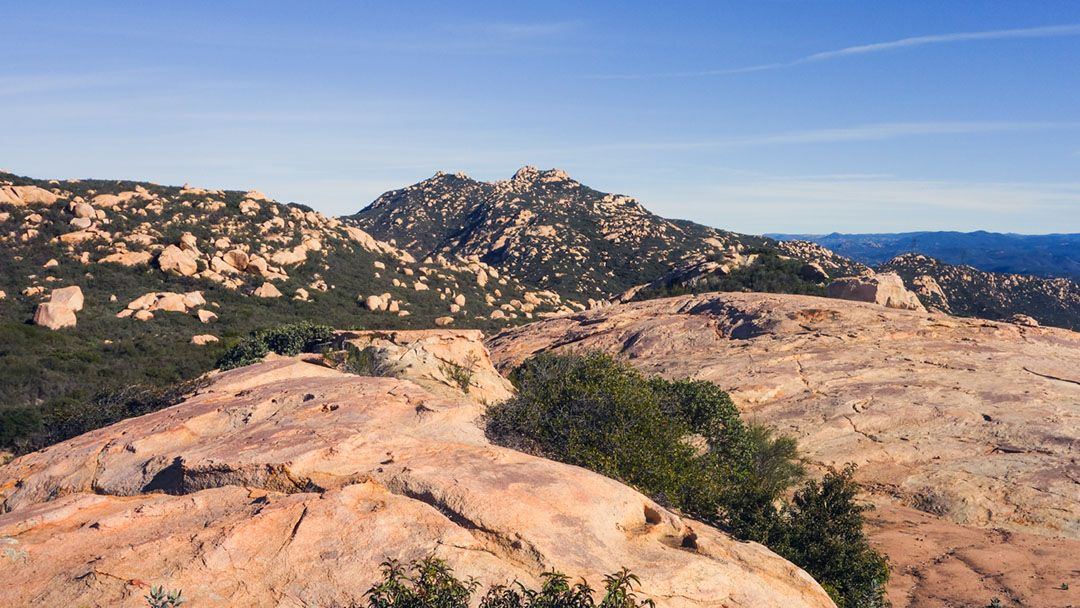
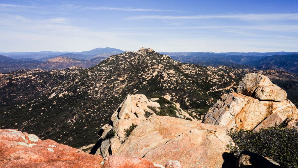
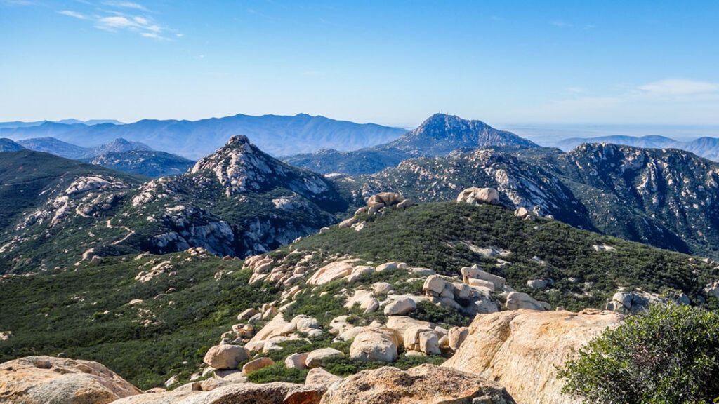
Once you’ve reached the top, take a moment to enjoy the incredible views that you’ve worked hard to see. They’re remarkable and distinctly different from those you get while standing on top of Lawson Peak.
My Experience Hiking Gaskill Peak
Just as with my experience hiking Lawson Peak, the only thing that didn’t excite me about my visit to Gaskill Peak was the hike up from Lyons Valley Road. Once I left Wisecarver Road and headed off into the brush to find Gaskill Peak, my adventure meter started buzzing.
I missed the summit trail on my first visit, which was a huge disappointment. However, on my second visit, I arrived prepared with a new plan. By taking advantage of Google Earth’s satellite view of Gaskill Peak, I was able to identify a possible route to the top. Although the trail I found on Google Earth seemed faint, it was the only feasible path that stood out from the rest of the terrain. Following my hunch turned out to be the right plan, and my second attempt at Gaskill Peak was a success.
The climb to the summit is a little challenging, but not too technical until you reach the base of the summit. I had to work a bit to find a safe route to the top, but I was pleased that I didn’t give up too quickly.
Standing on top of Gaskill Peak is like standing on top of the World. The day was clear and the views were unlike any I’ve found in San Diego to date.
Conclusion
Gaskill Peak and Lawson Peak are two of the most rewarding hikes in San Diego County. While the hikes can be challenging, and require some off-trail navigation, the stunning views from the summits make the effort more than worth it.
Hopefully, the tips I’ve shared in these two reports will help you to plan and execute a successful hike to Gaskill Peak and/or Lawson Peak. So grab your hiking boots, prepare your pack, and get ready to experience some of the best hiking that San Diego has to offer!
Tips
- Parking at Mile Marker 13 requires an Adventure Pass
- There are no facilities or trail signage at this location
- Bring at least 2 liters of water, there’s very little shade
- Remember to bring sunscreen and sunglasses
- Wear a good pair of hiking shoes or trail runners
- Wear long pants to contend with trees, brush and rocks