Pine Mountain Trail Loop: A Summit Adventure Hike in the Laguna Mountains
If you’ve been following my hikes, you’re likely aware that I’ve been tackling San Diego’s Highest Peaks. On Monday, I headed to the Laguna Mountains to hike Garnet Peak and Pine Mountain Trail, my 17th and 18th peaks.
While Schad’s hiking guide, Afoot & Afield: San Diego County, provides detailed descriptions of both hikes, my experience on the trail was slightly different than what the guidebook describes. Now I can share my adventure on Pine Mountain Trail and how I found my path to the summit.
RELATED: Pine Mountain Loop Trail the Long Way around in the Laguna Mountains
Accessing Pine Mountain Trail
I knew the summit of Pine Mountain was accessible, but I was uncertain about the route. With a starting point for the hike, GPS, and a map, I set off to find Pine Mountain’s summit.
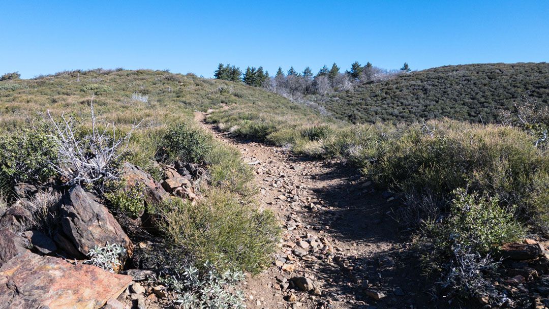
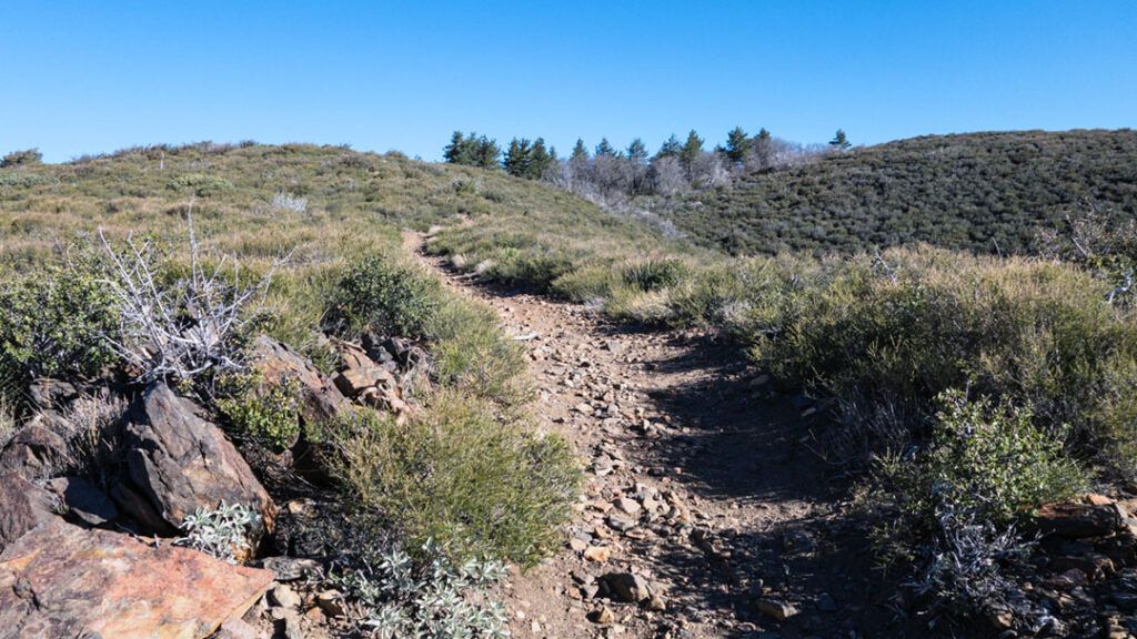
Pine Mountain Trail is accessible from the trailhead near mile marker 29.3 on the west side of the Sunrise Highway. Fresh tracks left by hikers and mountain bikers cover the well-traveled trail. Despite this, I didn’t encounter anyone else on the trail during the five hours I spent hiking.
After leaving the trailhead, I arrived at a four-way junction at Indian Potrero Road. I crossed the road to follow a sign that said “Pine Mountain Trail” and continued hiking southwest. To the northwest, I saw the pine tree-covered summit that gives Pine Mountain its name. I was confident that if I continued working my way along the trail, eventually I would find a way up.
Navigating with Map in Hand
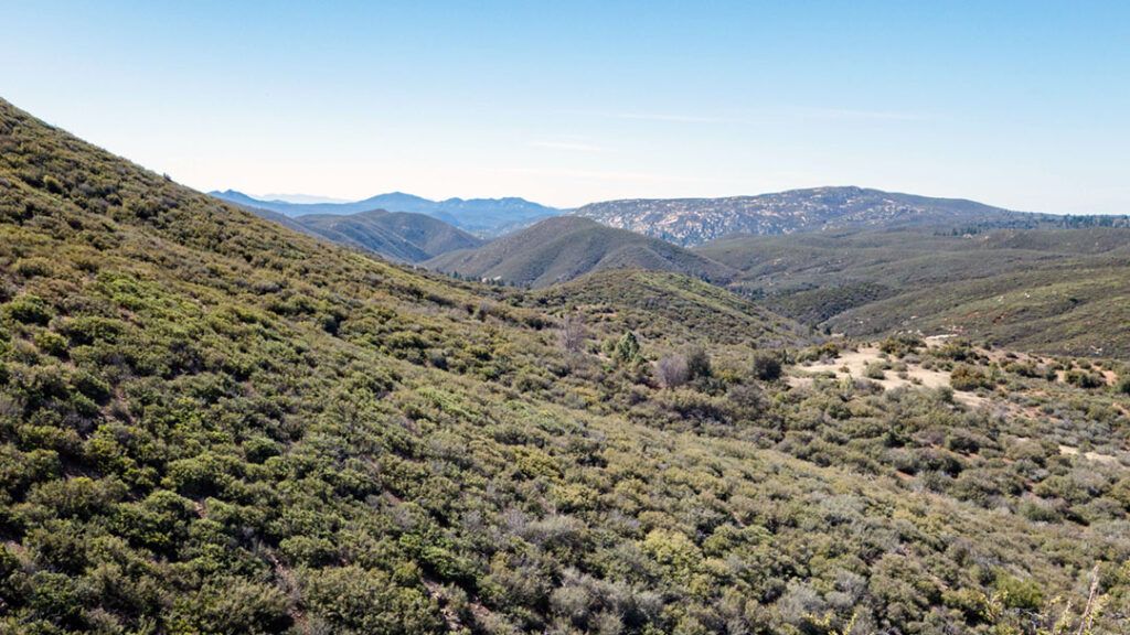
After hiking for about 2.5 miles, I reached the Indian Creek Trail crossing. The trail to my left went south into the valley towards Indian Creek. I didn’t want to go to reach the summit. I quickly ruled that out as an option for reaching the summit. The trail to my right headed northwest towards Pine Valley Creek and the Cuyamaca Rancho State Park boundary. That felt like the best choice.
I wasn’t excited about the prospect of heading downhill when all I wanted to do was go uphill, but my map offered a tiny glimmer of hope.
According to the map, if I followed the trail west for about a mile, I would find a connecting trail cutting across the hillside to Indian Potrero Road. Following this shorter route to the north face of Pine Mountain would save me about 4 miles.
Cautiously optimistic, I folded up my map, threw my pack back on, and followed the trail west into the valley in search of Indian Potrero Road.
What did I Miss?
Shortly after leaving the intersection I passed the point where I thought the shortcut should be. The topographic lines on my map showed the location to be around 5300 feet in elevation. My GPS indicated that I was 100-200 feet below that level and descending quickly. Despite this, I decided to continue hiking, hoping that the map was slightly off in scale.
As I fell below 5000 feet, I knew for sure that I wasn’t going to find the shortcut. I was once again faced with a dilemma: head back and call it a day, or hike the extra four miles to the north side?
I opted to continue my descent into the valley, eventually landing on Deer Park Road, a fire road paralleling the Cuyamaca Rancho State Park boundary. Then I followed Deer Park Road north along the boundary to Indian Potrero Road, where I would begin my ascent back up the northern face of Pine Mountain.
Finding the Summit
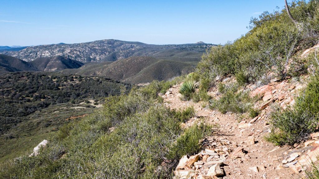
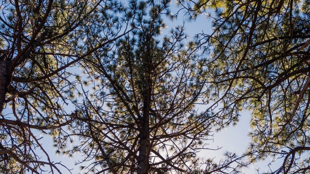
The hike up started slowly, but an ever-expanding view of the valley below and distant neighboring peaks to the southwest soon greeted me. The rewarding scenery refreshed my spirit and renewed my optimism.
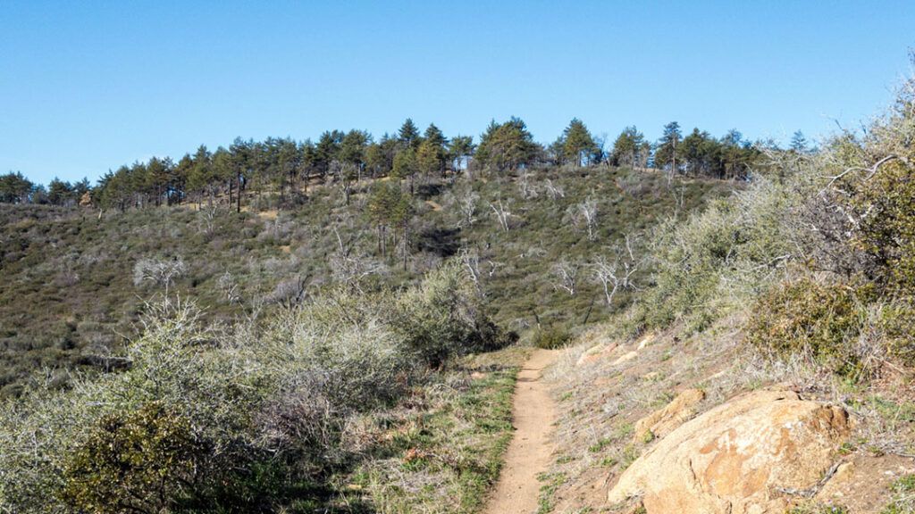
The pine tree-covered summit was once again in clear view. I was closer to it than I had been at any other point. Then, all at once, the trail opened up and the summit was sitting directly in front of me.
The top of the mountain is made up of a series of rolling hills that are covered with grass and pine trees. It was like an oasis in an otherwise barren desert. The only problem was that the trail I was on appeared to go around, and not to, the summit. Then I found it. Years-old tire marks, covered in grass and only faintly visible, going off-trail across the field and up into the pine trees. A sign near the tire marks said, “No Vehicles.” Nothing about feet or hikers, so off I went, following the faint path to the summit.
Off the Beaten Path to Pine Mountain
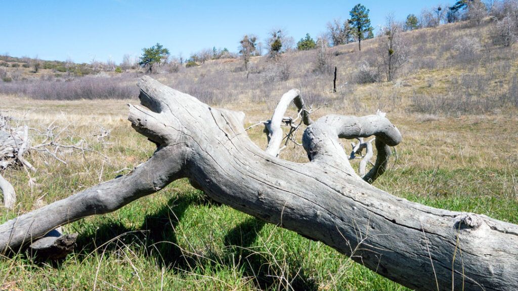
The tracks soon faded away, but my path was clear and a quick look at my map told me where I could find the summit. The hills were covered in thick layers of grass and fallen leaves that were practically undisturbed, but there was evidence of light use. I’m not entirely sure if the spotty path I followed was made by previous hikers or local wildlife, but it was just clear enough to follow.
As I wandered through thickets of brush and fallen trees, I couldn’t help but notice the peaceful sounds of the forest around me. Wind whistled softly as it whipped through the pine trees above me, leaves crunching beneath my feet with every step, and birds singing in the sun. I paused momentarily to take it all in, and I thought, “This is how nature is supposed to be.”
We’re so often caught up in the moment that we forget to take notice of what’s going on around us. I started hiking to distract myself from my daily life and to get into better shape. As I became a stronger hiker, I started setting goals and challenging myself with longer distances, higher elevations, and faster times.
Since starting this blog, I’ve learned to slow down and take the time to notice the world around me while I hike. By letting nature in, a whole new world has opened up for me. While I still like to challenge myself and push my limits, it’s no longer my sole focus. Moments like this, standing under the shady pines on top of this mountain, stop me dead in my tracks.
This is why I hike, for moments just like this. I was invigorated with a sense of accomplishment and refreshed by the experience, so I ventured on.
A Hike Defined by the Adventure, not Peak Bagging
Soon I was standing atop the highest point on Pine Mountain at 5640 feet. The views were obstructed by the forest around me and the moment had passed. The summit experience was underwhelming, but the adventure of getting there made it worthwhile.
It was time to leave this beautiful place and finish my hike.
After walking a couple of hundred yards north I was back on Indian Potrero Road. From here it was a quick and relaxing two-mile hike back to my truck, where I would briefly reflect on my experience before returning home.
As I made my way back to my truck, I couldn’t help but feel a sense of accomplishment and rejuvenation from my hike on Pine Mountain Trail. From the breathtaking vistas to the peaceful sounds of the forest, this trail offers an unforgettable experience for hikers. So if you’re looking for an escape from the hustle and bustle of everyday life, be sure to give Pine Mountain Trail a try.
Tips for Hiking Pine Mountain Trail Loop
- Adventure pass or day-use pass is required for parking
- Wear a good pair of hiking shoes or trail runners
- Shade is sparse, so dress accordingly and wear sunscreen
- Look for the trailhead across the street from the Pioneer Mall Picnic Area
- Shorten your hike to the summit by taking Indian Potrero Road north at the first crossing
This is a great report of your hike. I’ve hiked on this area and I would agree with you about the importance of slowing down to enjoy nature. It usually takes me longer than planned when I hike because I like to stop to enjoy the place and take pictures. Hiking is never just about exercising for me, I do it more to relax my mind and energize my spirit. Thanks for sharing your experiences on the trail, I love readying this!
I’m slowing down more and more these days as my priorities continue to shift. More pictures and just enjoying the moment, and less hiking. Thanks for sharing, and I’m glad you enjoyed it!