Lawson Peak Trail: Hiking, Scrambling and Climbing to the Summit
Lawson Peak is a hike you do for the challenge, not simply to get out in nature. The scramble to the summit may test your nerve if you are not a practiced rock climber. Although it can be challenging in some areas, determined peak baggers will reach the top.
RELATED: Lawson Peak Trail in Cleveland National Forest
Lawson Peak Trailhead & Parking
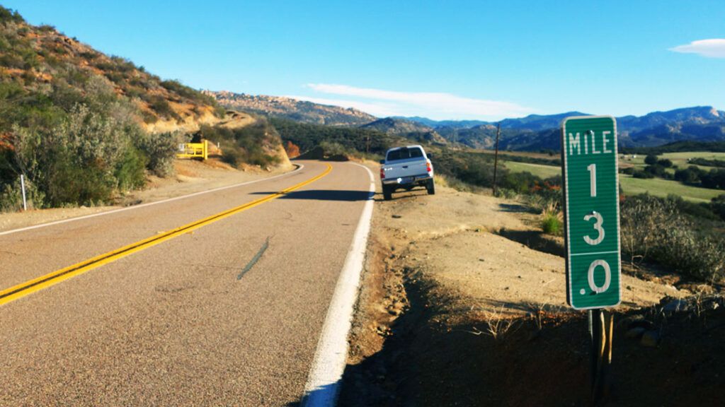
The gated trailhead for Lawson Peak trail is located near mile marker 13 on Lyon’s Valley Road. Aside from the gate and mile marker, the trailhead is plain and unmarked. You must have an Adventure Pass when parking in Cleveland National Forest.
The trailhead doesn’t offer a view of Lawson Peak or Gaskill Peak (Lawson’s sister peak), and gives no hint at the challenging adventure ahead.
Hiking Lawson Peak Trail
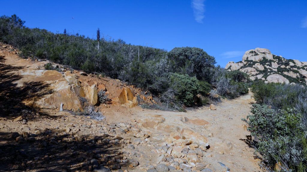
After parking, pass the gate and start the 2-mile uphill hike. Lawson Peak trail, a weather-beaten fire road, presents an obstacle course of rocks, ruts, and loose dirt.
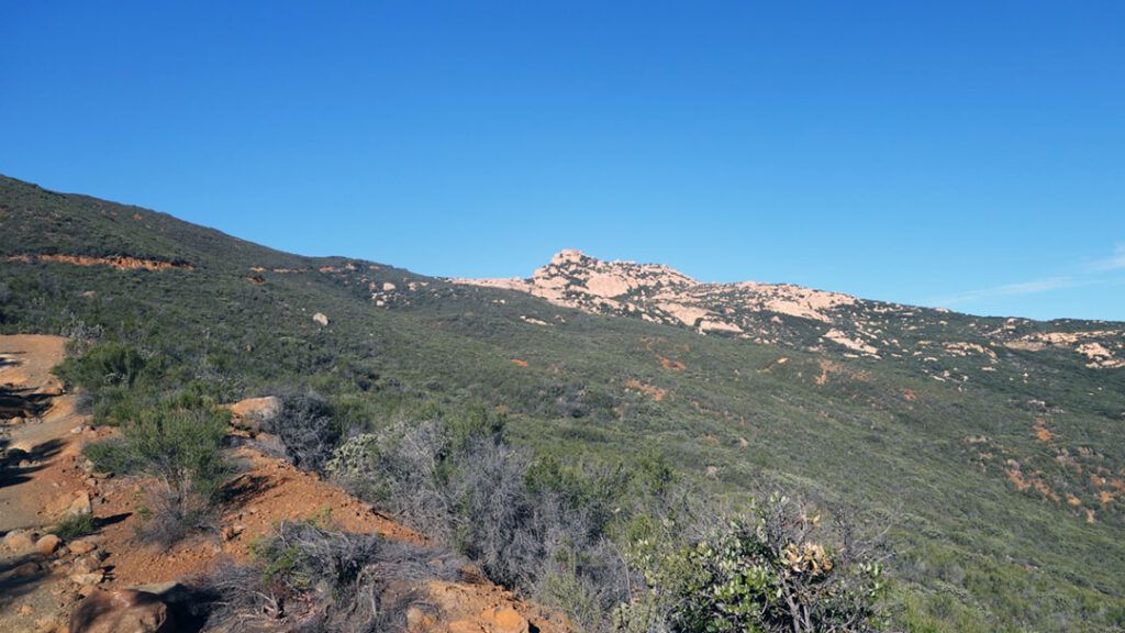
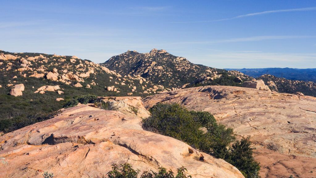
Within just a minute or two of starting the trail, Gaskill Peak comes into view to the northwest. Around the one-mile mark, you’ll get your first glimpse of Lawson Peak. The boulders that make up the peak are unmistakable and stand out from the green backdrop of California chaparral surrounding you.
Take an Optional Detour for 360-degree Views
Near the top of the hill, a scenic lookout offers 360-degree views. To find it, look for a wash on the left side of the trail as you’re nearing the top of the hill. Follow the wash southwest for a couple of hundred yards. It will take you to a small peak where you can get your first 360-degree view of the surrounding mountains.
Pancake Rock & On Towards Lawson Peak
Pancake Rock, a large granite boulder that’s as flat as a pancake, is located on the north side of the trail. It’s an easy climb to the top, where you will get an up-close view of Lawson Peak to the west, Gaskill Peak to the northwest, and the valley and mountains behind you to the east.
The trail to Lawson Peak continues over the top of the hill and skirts along the western edge of Pancake Rock. If you’ve detoured to Pancake Rock, access the trail without backtracking by making your way to the southwest edge of the rock. There, you’ll find a slope gentle enough to walk down carefully to where you will meet with the trail again below.
Follow the trail north along the edge of Pancake Rock to reach the Wisecarver Road crossing at the base of Lawson Peak. At this point in your adventure, you can hike north another 1.5 miles to Gaskill Peak or continue to Lawson Peak.
The Final Approach
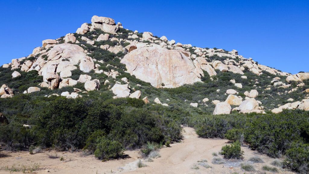
Head west toward Lawson Peak until you find a small trail at the base of the peak leading towards the mountain. Step into the brush and follow the trail up the peak’s hillside. The trail gradually gets steeper, and soon you’re spending less time hiking and more time climbing up, around, and over boulders.
Most hikers won’t find the rock scrambling at this point too difficult.
Wear long pants if you don’t want your legs to get scratched up, especially if you plan to summit the peak. If the trees and brush don’t get you, the ascent to the summit certainly will.
Summiting Lawson Peak
You’ll start your scramble for the summit by following the trail over and around the top of the mountain towards the northwest side. Next, continue moving south around the back of the granite peak. Then, as you reach the westernmost face of the peak, you’ll find the crack shown in the photo below.
While there are several ways to reach the summit, most reports and people I’ve spoken with suggest that climbing to the cave at the top of this crack is the safest route.
Once you find it, prepare to grab ahold of anything you can as you climb your way up each of the three stone steps leading to the cave above.
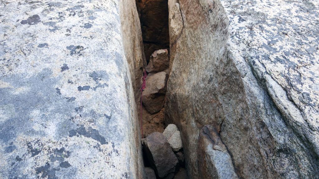
There is an opening in the roof towards the back of the cave. Climb through the cave to the next level, and you’ll be at the base of your last scramble to the summit. Choose a direction and start climbing.
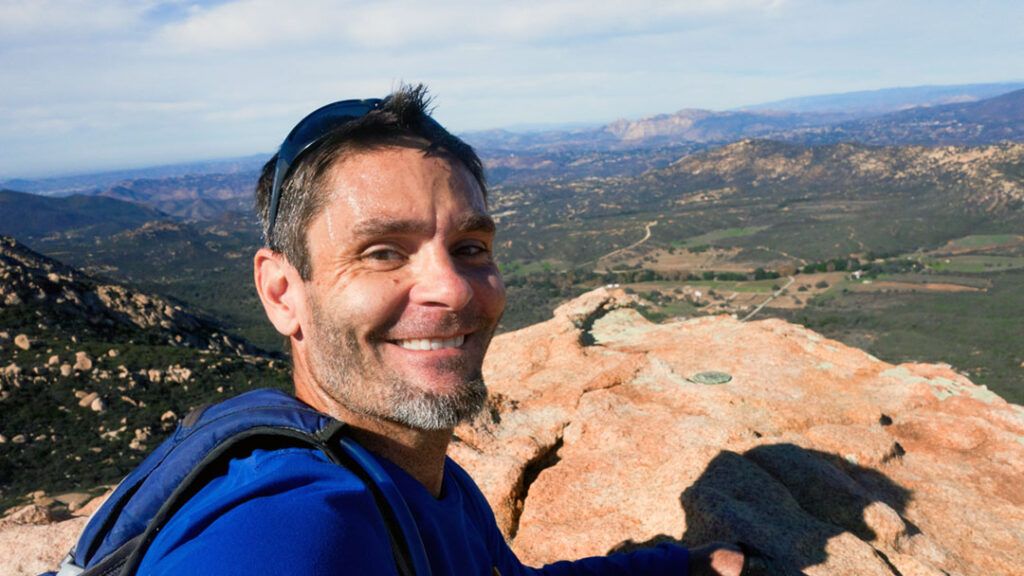
Congratulations! You’ve just reached the summit of Lawson Peak.
The Reward
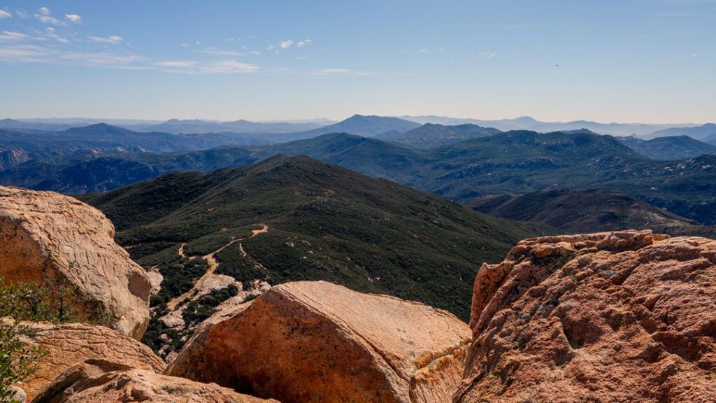
Take a break, relax, and recuperate while enjoying the rewarding countryside views.
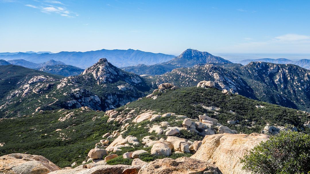
On a clear day, you can see Gaskill Peak clearly to the immediate north, while Palomar Mountain is visible in the distance. El Cajon Mountain can be seen to the northwest, while Iron Mountain and Mt. Woodson can be seen in the distance. To the west, Point Loma and Mount Soledad are visible on the coast. Looking east, you can make out Corte Madera and Los Pinos Mountains. And in the south, Tecate Peak and Otay Mountain stand tall against the Mexican border.
My Experience Hiking Lawson Peak
I enjoyed this hike, even though I had to attempt it twice before finally summiting Lawson Peak.
On my first visit to Lawson Peak, I was unprepared for the difficult final ascent. Despite giving it my all, I failed to find a safe way to the top. Little did I know, however, that the solution was just a few steps further down the trail. When I got home, I sat down to lick my wounds and do some more research. One week later, I returned with the determination to succeed.
On my second attempt, I crossed paths with another hiker who gave me clear directions to the summit. He recommended scaling a slope about 15 feet back up the trail from the cave entrance. Because the cave was intimidating, I decided to try climbing the slope first. While there were good holds, I lacked enough experience in bouldering to make it up. My shoes wouldn’t stay stuck long enough to get up the side of the rock.
I was determined not to leave empty-handed from Lawson Peak a second time. So I returned to the cave entrance and started climbing up the stairs. With some luck and determination, I finally arrived on top of the summit.
I always enjoy a good challenge, and the view from the summit was more than worth the effort to get there.
The trail leading up from the road left me a little underwhelmed. It’s steep, and you’ll get a good workout climbing it, but it’s kind of a boring hike. Aside from the valley and the views of the surrounding mountains to the east, there’s not much to look at until you reach the top of the hill.
All in all, it was a fun hike and one that I highly recommend. Just be ready to get a few bumps and scratches along the way, especially if you want to summit the peak.
Conclusion
In conclusion, the hike to Lawson Peak is challenging, making it a great choice for experienced hikers who want to test their limits. While the trail offers views of nature and the surrounding mountains, it’s not the most scenic hike. The scramble to the summit requires some basic rock-climbing skills, and it might also test your courage.
The trail leading to the top of the hill and beyond to Gaskill Peak is accessible to children and dogs, and most of it is open to mountain bikes. However, the rough terrain may not be ideal for biking. I don’t have much experience with mountain biking, so it’s best to check with someone with more expertise.
Trail running can also be a challenge due to the rough terrain. I slowed down often to avoid rolling my ankle or slipping on sand-covered ridges.
Lawson Peak is no ordinary hike. But if you’re looking for adventure, head to Lawson Peak trail and find your way to the summit.
Tips
- Parking at Mile Marker 13 requires an Adventure Pass
- There are no facilities or trail signage at this location
- Bring at least 2 liters of water, there’s very little shade
- Remember to bring sunscreen and sunglasses
- Wear a good pair of hiking shoes or trail runners
- Wear long pants to contend with trees, brush and rocks