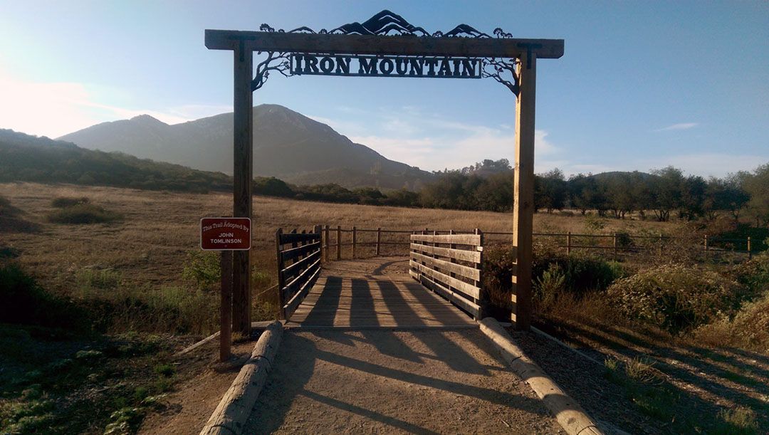
Iron Mountain Peak Trail Hike – The “Short” Trail
When it comes to views of the local mountains, the view from the summit of Iron Mountain Trail in San Diego is as good as it gets. The family-friendly hike begins in Poway off Highway 67, just a few short miles from another favorite hike of mine, Mt. Woodson. At about six miles round trip, the “short” trail is not exactly short. But if you don’t mind the distance, it will take you on a scenic, gradual, winding trip up to the 2698 ft. peak.
RELATED: Iron Mountain Trail: A Captivating Hike in Poway, San Diego
Hiking Iron Mountain Trail
The summit of Iron Mountain is visible from the parking lot at the base of the mountain. One quick look can leave you both inspired and intimidated. Not to worry though, it’s not as tough as it looks, but delivers twice as much as it impresses.
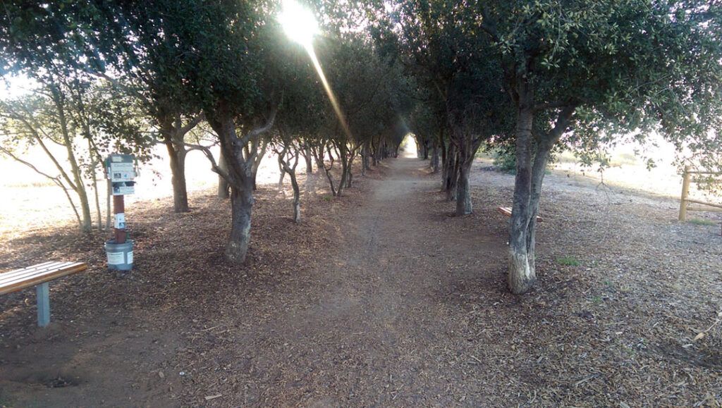
Iron Mountain Trail begins easily enough with a peaceful walk through a tunnel of shade trees, which is refreshing at the end of the hike. Following a brief walk along a fire road, the trail narrows and becomes slightly steeper, winding up the boulder-strewn mountainside.
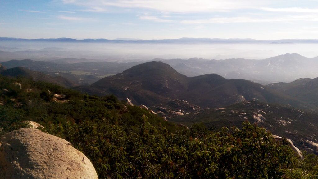
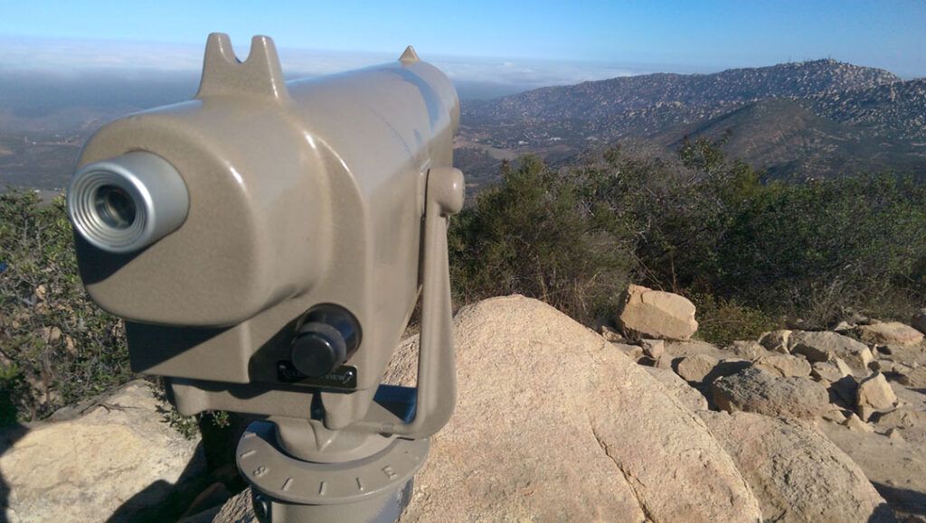
Soon, the trail begins to zig-zag up the face of the mountain, making the climb manageable while providing plenty of spots to rest and take in the constantly changing views. The summit is almost always in view like a lighthouse beckoning hikers to keep moving up. And just as suddenly as it all began, the trail ends, letting out into a set of observation points scattered across the peak offering views in every direction for as far as the eye can see.
Reflecting on the Iron Mountain “Short” Trail Hike
I enjoyed the Iron Mountain Trail hike. For an out-and-back trip, it was a surprisingly fun trek. There was an amazing and never-ending assortment of interesting rock formations to keep your mind off the task of hiking. And once the mountains to the east came into view, I could hardly keep my eyes on the trail. What made it even more remarkable was how the view changed so dramatically as we worked our way along the trail and up the mountain.
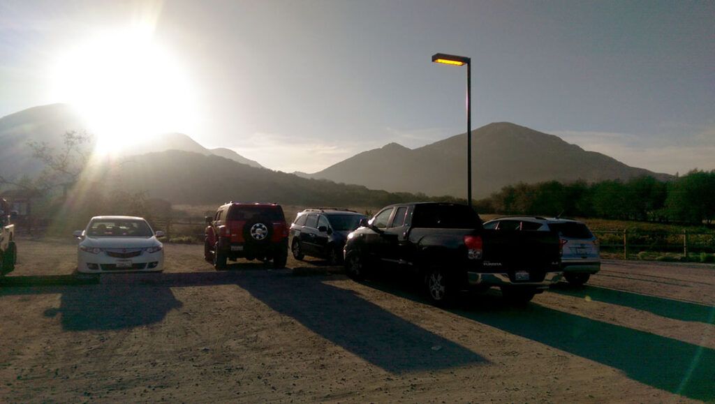
Iron Mountain’s “short” trail wanders its way over boulders, through thick groves of manzanita, and around interesting rock formations. The elevation gain is manageable with the help of switchbacks that zig-zag their way up to the summit. We started the hike at 7 am on a weekday morning in early August. When we arrived, the parking lot already had several parked cars, which is indicative of the trail’s popularity. We passed a variety of hikers on our trip, spanning every age and fitness level imaginable. Despite their diversity, the hikers on the trail all had one thing in common – they were all having fun, which was clear by the smiles on their faces.
It can get hot out there, and there’s not a lot of shade available once the real hiking starts just past the base of the mountain. So get an early start if you can, and be sure to bring plenty of water!
Conclusion
The trail is free to use, and no fees or registration is required.
Hikers, runners, mountain bikers, dogs, and even horses, in some areas, are welcome on the trail. There’s plenty of parking at the trailhead, so you don’t have to worry about hiking too far to start the hike.
This is a family-friendly hike that will leave you invigorated and inspired. Get started early to beat the crowds, bring plenty of water, and you are certain to embark on a hike that you won’t soon forget.