Eagle Peak San Diego in Cleveland National Forest
Nestled within the lush confines of Cleveland National Forest in San Diego, Eagle Peak trail offers a moderately-challenging yet immensely rewarding hiking experience. This 4.2-mile out-and-back trail is a favorite among hikes near Julian, CA and serves up stunning vistas that are well worth the effort.
RELATED: Three Sisters Falls - A Springtime Reunion Waterfall Hike
Trailhead Information and Facilities
The trailhead for Eagle Peak is conveniently shared with the popular Three Sisters Falls Trail. Keep in mind that an Adventure Pass is required to embark on this journey. While facilities at the trailhead might be minimal, ample parking is typically available for eager hikers. Plus, don’t forget to bring your furry friends along – leashed dogs are welcome!
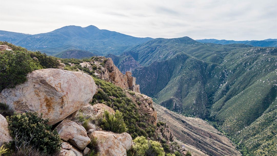
About Eagle Peak
Flanked by gorgeous vegetation and unique topography, Eagle Peak stands tall at an elevation of 3,226 feet. This trail is moderately challenging, requiring a decent level of fitness due to its 1,200 feet elevation gain. However, it’s not insurmountable – hikers of varying ages have conquered the peak. In addition to serving as one of the top hikes near Julian, the trail’s pet-friendly nature adds to its appeal.
Hiking to Eagle Peak
From the shared trailhead, make your way upward along the well-marked paths. As you journey on, you’ll notice a trail leading left and down into the valley — that’s Three Sisters Falls trail. Continue on straight until you reach a smaller trail leading into the brush and towards Eagle Peak. Savor the exhilarating hike, taking breaks to enjoy the majestic views of Cuyamaca Peak, Viejas Peak, El Cajon Mountain, and Mount Woodson. Remember, the journey is just as important as the destination!
What to Expect on Your Eagle Peak Hike
Expect a mix of terrains along the trail – it’s a fun challenge for any adventurous spirit. Given the exposure to the sun, bring plenty of water, sunscreen, and wear appropriate footwear. As you hike, keep an eye out for the local wildlife and unique plants native to this part of the Cleveland National Forest.
When to Go
- Fall
- Spring
- Winter
What to Bring & Wear
- At least two liters of water
- Hiking shoes or boots with plenty of traction
- Sunscreen & hat