Eagle Peak Hike – Heading Out from Three Sisters Falls Trail
Eagle Peak is a frequently overlooked hike that shares a trailhead with Three Sisters Falls. With an elevation of 3226’, it is currently ranked 69th on the 100 Peaks of San Diego County list.
RELATED: Eagle Peak San Diego in Cleveland National Forest
Trailhead to Eagle Peak Trail
My friend Ian and I began our hike to Eagle Peak from the trailhead at approximately 7:30 am on a Tuesday. The sky was overcast, and the air was cool, but not cold. Weather forecasts predicted temperatures in the low to mid-80s by late afternoon, so we knew it would warm up soon.
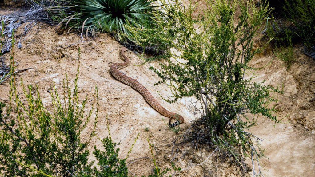
After researching the hike beforehand, I was aware of the potential for some light bushwhacking and rock scrambling. As it is early spring and I have already encountered one or two rattlesnakes on the trail, I went in prepared.
The Hike to Eagle Peak
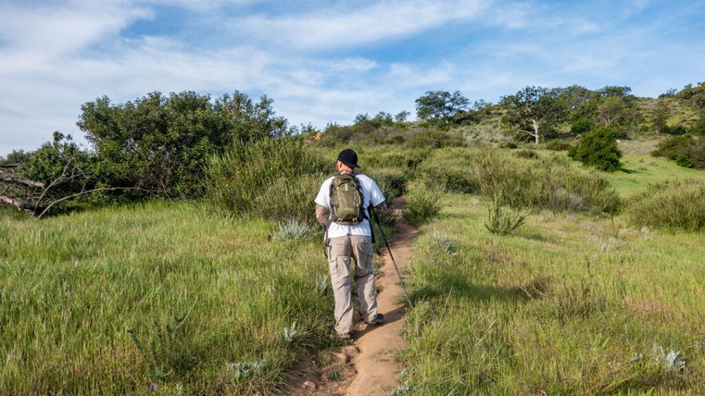
We were happy to find that there wasn’t much bushwhacking on this hike. Although the trail to Eagle Peak is narrow and surrounded by dense brush, it’s well-traveled and easy to follow.
The trail follows the contour of the mountain as it works its way toward the first of several false summits before eventually leading to Eagle Peak. There is some elevation gain, but it’s fairly minimal, which makes this hike one of the easiest I’ve done to date on the 100 Peaks list.
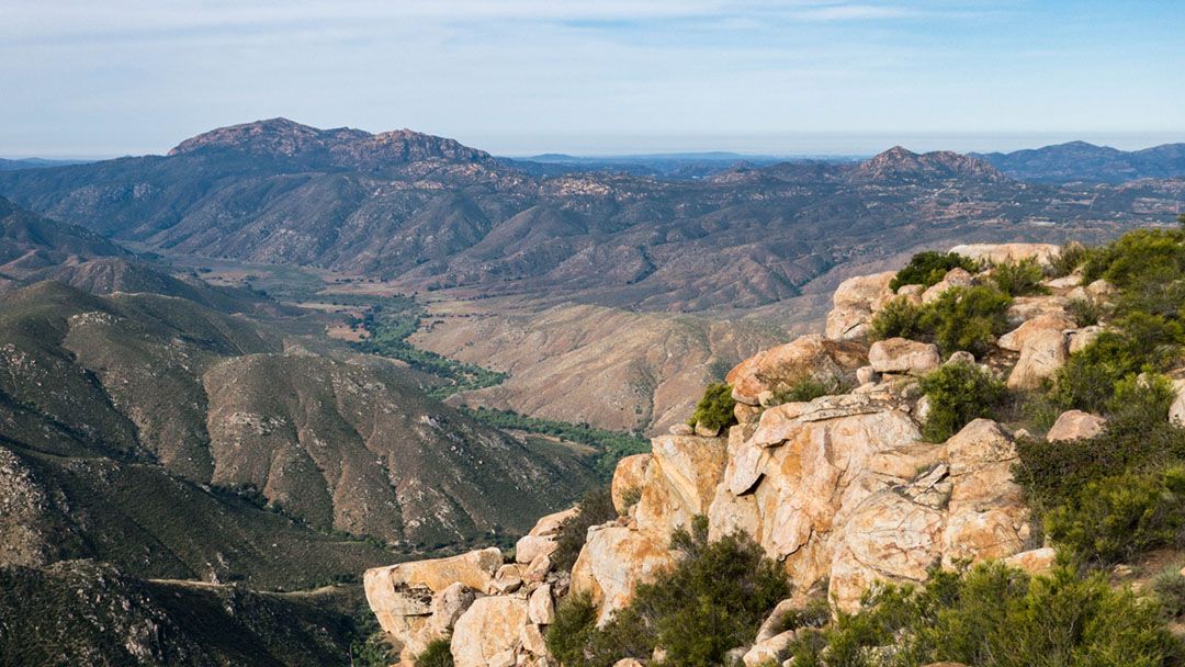
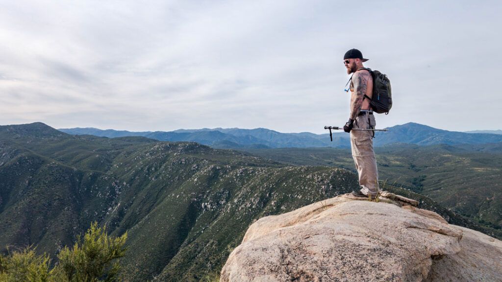
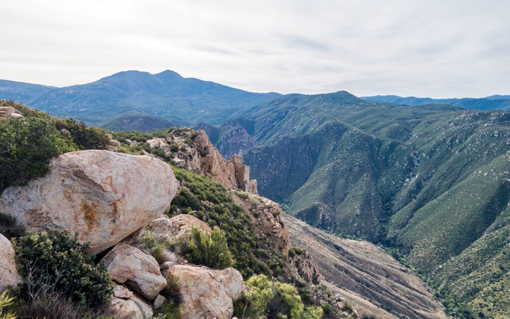
As we worked our way towards the summit, we found several south-facing lookouts where we stopped to take in the views and assess our progress. A couple of the lookouts had large boulder structures on the ridge that offer unobstructed views of the valley below.
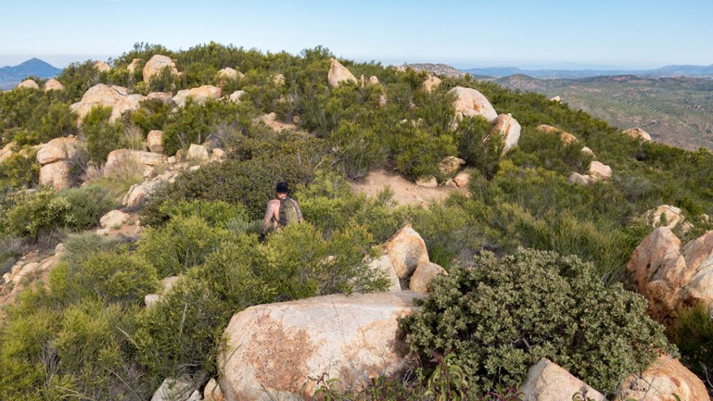
After several stops, we eventually reached the summit of Eagle Peak. There we found a couple of survey markers letting us know that we had made it. The summit itself is broad and unremarkable. If you explore its perimeter you will find several spots where you can enjoy a clear view in any direction.
Despite the hazy and overcast weather, we could see landmarks in every direction from the summit. To the north, Palomar Mountain was visible. To the east, we could identify North Peak, Middle Peak, and Cuyamaca Peak. Viejas Mountain was visible to the immediate south, with several other identifiable peaks behind it. Looking west beyond El Cajon Mountain, we could see Mount Woodson and Iron Mountain in the distance.
Conclusion
Eagle Peak offers a fun, moderately short hike with stunning views that won’t leave you exhausted for days. The trail is easy to follow and can be hiked on its own or as an add-on hike while hiking Three Sisters Falls. It’s a lesser-known destination than Three Sisters Falls, and many hikers aren’t aware of the trail’s existence, making it an ideal hike if you want to avoid crowds.
Eagle Peak is a great hike for kids and dogs alike, so pack up the family and head to Eagle Peak for a fun day of peak bagging.
Tips:
- Wear long pants to protect your legs from the overhanging brush
- There is no shade on the trail, so bring plenty of water
- Hike with caution and keep your eyes open when snakes are out and about
- Keep dogs on a leash if hiking during snake season
Sonidos good!