Coyote Canyon Trail – Two Days Backpacking the Anza Borrego Desert
The Coyote Canyon Trail hike takes you along the same path that Juan Bautista de Anza followed during his 1775-6 colonizing expedition from Sonora, Mexico to the San Francisco bay. With water running year-round in the creek, it’s easy to understand why de Anza chose this route through the desert.
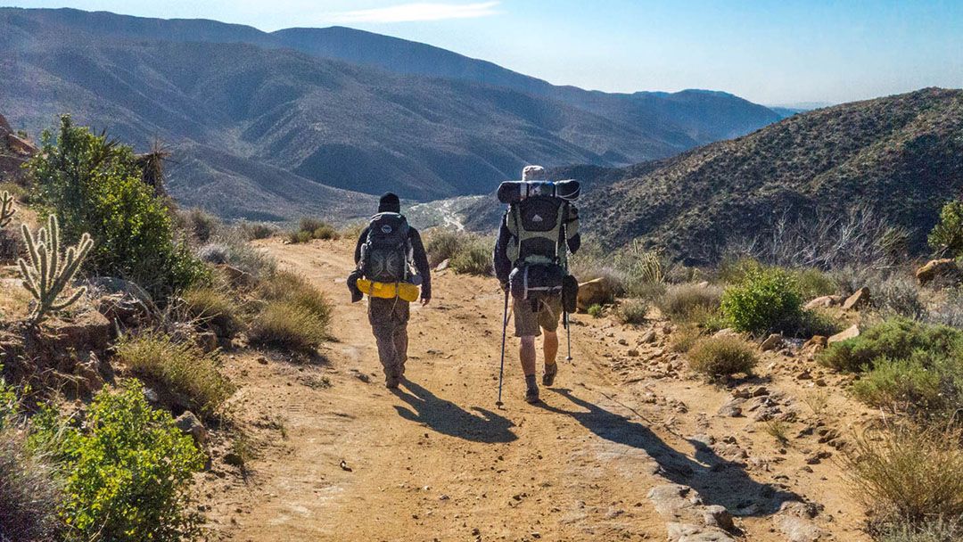
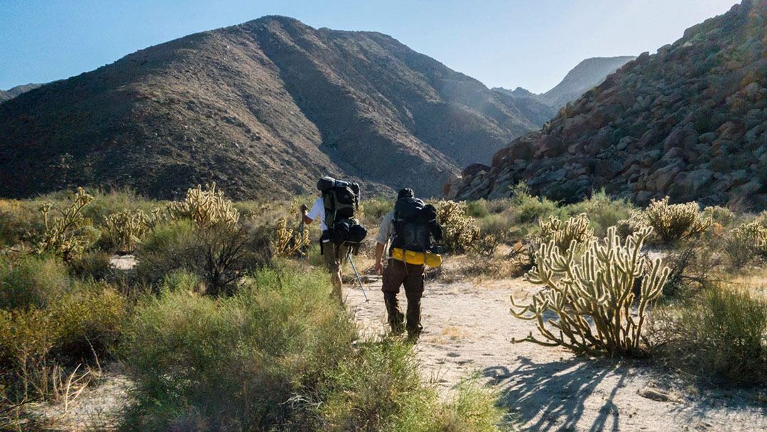
It’s All Downhill from the North End of Coyote Canyon Trail
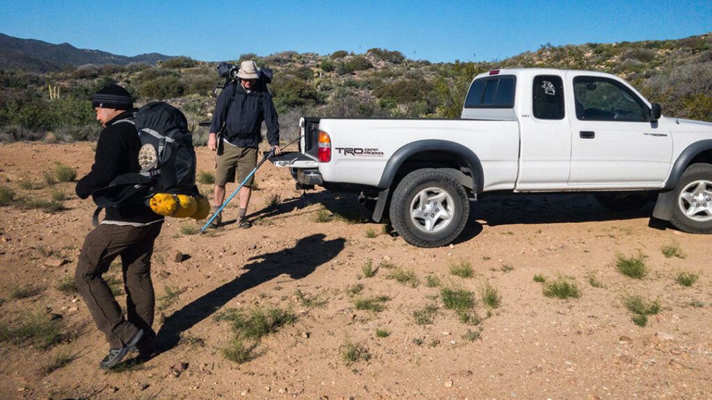
We started our two-day trip on the north end of the canyon on Coyote Canyon Road. We left a second vehicle on the south end where the pavement meets the dirt on Di Gorgio Road. The plan was to hike south, pick up the second vehicle, and shuttle back to pick up our first. Two days and 23 miles of easy hiking and fun in the sun.
The great thing about starting on the north end and hiking point-to-point is that the entire hike, all 23 miles of it, is downhill. Our total elevation gain for the hike was around 440 feet, while our loss was over 3100 feet. When you’re hiking in the desert, and it’s hot and dry, following a 23-mile path downhill doesn’t suck.
Into the Willows
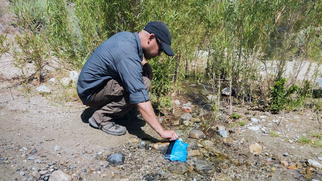
After a brief hike down into the canyon, you begin a long stretch hiking along the river wash. Before long, you’ll run into the first of three oases, known as Upper Willows, Middle Willows, and Lower Willows.
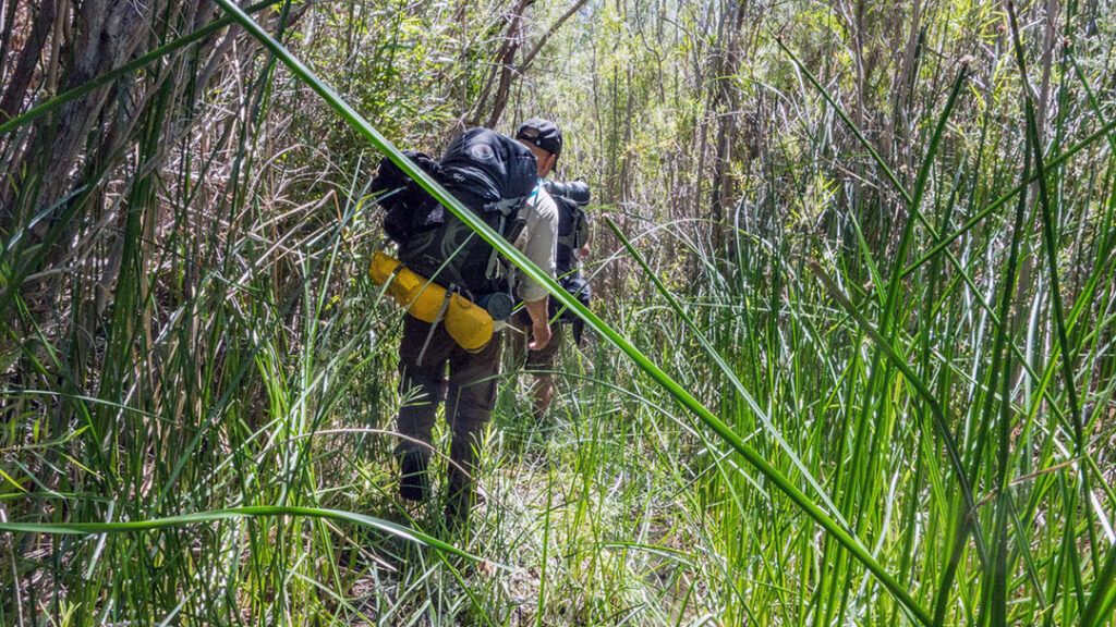
The Oasis are fed by natural springs that flow year-round. The willows are closed to the public between June 1 and September 30 each year to protect the water sources for the rare peninsular big-horn sheep. The path through them is relatively clear, though you will get a little muddy and wet along the way. Not to worry, your shoes will dry out in the desert sun nearly as quickly as they got wet.
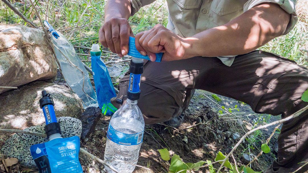
The Willows are the only reliable natural water sources along the hike, so we stopped at each in the shade to fill up.
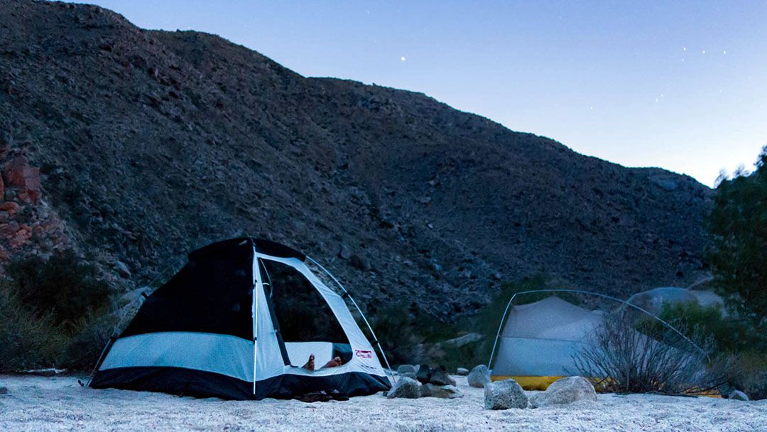
Finding Camp in Sheep Canyon
Although the trail is relatively easy to follow, navigating the desert is pretty straightforward, so we spent a lot of time off the trail. The only drawback to going off-trail is that there are a lot more sharp and pointy things to work around. Jumping Cholla Cactus are everywhere, so we had to keep an eye out as we made our way towards Sheep Canyon to camp for the night.
We set up camp on an island in the wash at the base of Sheep Canyon. The sand was white and cool and the canyon provided shelter from the wind. There are established campsites available for car camping within the canyon as well. We passed several sites that were occupied by campers who had driven in using 4×4 vehicles.
A Leisurely Start to Day Two
We woke up early and enjoyed a leisurely morning before packing up and hitting the trail for our hike out of Coyote Canyon. Our first stop was at Middle Willows, where we once again made our way through the oasis and filled up on water for the hike to Lower Willows.
By the time we reached Lower Willows, the temperature had climbed to around 90 degrees and we were ready for the cool water and shade waiting in the oasis. We stopped once again to fill up on water and take a lunch break, then headed out for the last 6 or 7 miles of our hike.
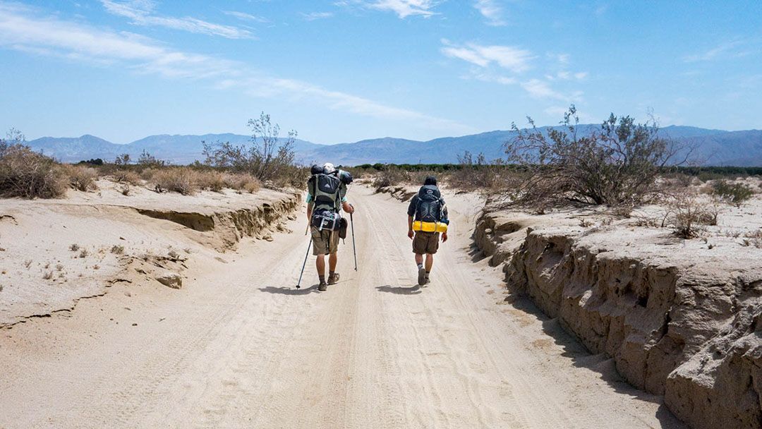
The Long Walk Out
The final stretch of our hike was tough. It was excruciatingly hot under the midday desert sun, and the road was long and dusty. Our progress slowed as we made our way out of the canyon and shade was hard to come by. We stopped around 3 pm one final time when we found a large Ocotillo tree that offered a shady reprieve. After a brief break and a chance to recoup and rehydrate, we hit the trail and made our way to our cars, which were waiting at the southern trailhead.
The Last Stop on Our Way Out of Town
On our way out of town, we stopped at Carlee’s for a cold beer and a burger. The food was great, and the air-conditioning was a welcome treat after a long hike in the desert.

Conclusion
Hiking the Coyote Canyon Trail in Anza Borrego along the historic de Anza route provides a fun adventure for those who are prepared for the desert environment. The trail has water year-round, stunning views, and plenty of space for remote camping. With a little planning and preparation, hikers can have a rewarding and memorable experience in this unique and beautiful landscape.
Looks like a fun trip. I’ll have to try to get some friends together and do it sometime.
It was a really fun trip. If you go, definitely make it a winter or early spring hike. When we went in late spring it was verging on too hot and the sun was brutal.
How difficult is it to reach the location where you started backpacking in Coyote Canyon? Is a 4WD vehicle required? We won’t have one, but I can handle a few extra miles of hiking.
Using maps, I figured you must have taken roads out of Anza. Would you please give specific directions. I’d like to have my wife drop me off at the north end and retreive me at the south end.
Hey Jack,
Thanks for stopping by!
The trek on the north end is rough, but we managed to get two 2-wheel drive Tacomas down there, albeit just barely. The road was uneven enough that I had one wheel in the air during a slow crawl at least once, and traction was iffy in a couple spots on our way out. If it’s muddy or if you don’t have a high clearance vehicle, I wouldn’t attempt the drive in.
I don’t have directions to the trailheads, but I do have a GPS ;track in both GPX and KMZ formats that I created during the hike. It has the north and south trailheads marked, along with some of the other waypoints along the trail. Email me directly if you’d like it. I’m happy to share, and it should guide you right to either end of the trail.
Robb
This trip intrigues me. It looks like you had a reliable water source. Do you know if it’s still there or dried up? I’m interested to see your GPS track if you have it available. Thanks!