South Fortuna Trail to North Fortuna via Visitors Center Loop Trailhead
About the South Fortuna Trail Hike
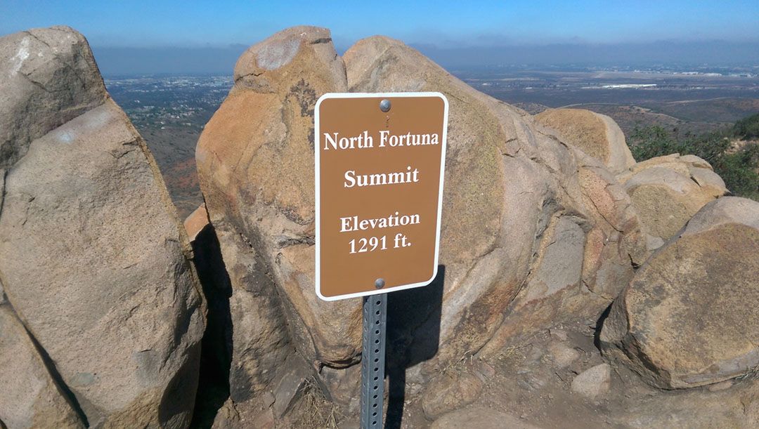
Mission Trails Regional Park is home to five of the highest peaks in the city of San Diego. The park also has several of the more challenging trails the city has to offer. At 1291 ft., North Fortuna Peak is the third-highest peak in Mission Trails Park. Cowles Mountain, at 1594 ft, and Pyles Peak, at 1371 ft., slip into positions one and two respectively. Finally, South Fortuna Trail takes you to South Fortuna Peak at 1094 ft., about one mile south of North Fortuna Peak.
RELATED: North Fortuna Peak via South Fortuna Trail in Mission Trails
The two peaks share a couple of common trails and stand on opposite sides of Fortuna Saddle trail.
North and South Fortuna Peaks can be accessed using any one of the many trailheads scattered throughout the park. Each trail offers its own set of unique challenges and includes a variety of route options. So bring plenty of water and plan on spending a few hours on the trail.
Getting Started
Arguably, the most challenging route to the two peaks is via South Fortuna Trail. The trail begins where the San Diego River Crossing Trail ends. The San Diego River Crossing trailhead has plenty of parking and is located southwest of the Mission Trails Visitors Center.
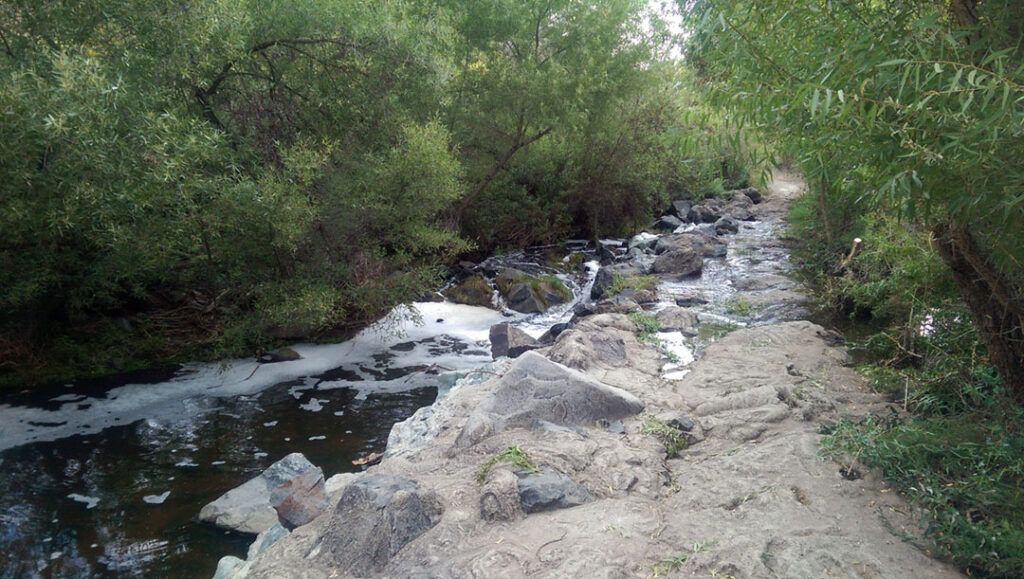
From the trailhead, you’ll follow a short section of dirt road down towards the San Diego River. The river level varies dramatically depending on the time of year and rainfall. When we were there in late July, we were surprised to find the water level was high and flowing freely.
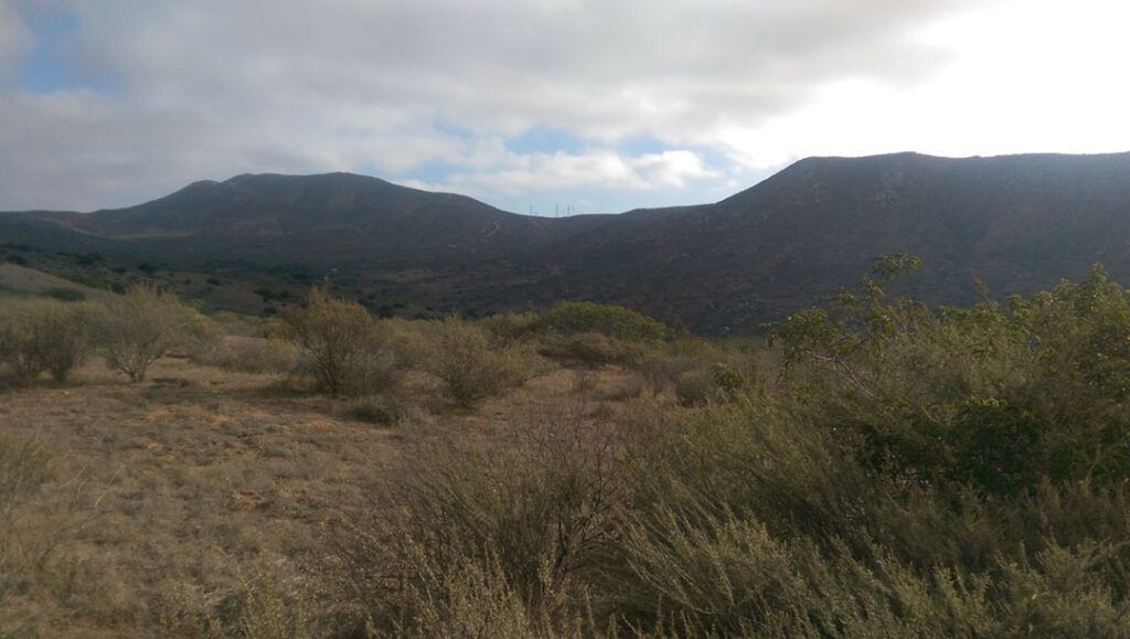
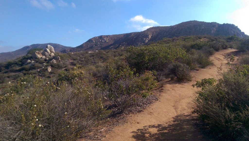
Once across the river, you’ll follow another dirt road section of the San Diego River Crossing Trail. Just before the road sweeps to the left is a trail junction for South Fortuna Trail. This is where you get your first close-up look at the North and South Fortuna Peaks.
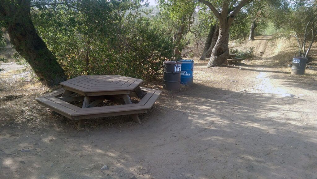
At the bottom of the hill lies the beautifully wooded Suycott Valley. Hidden among the trees is a quiet, shaded area with two picnic tables where you can rest and refuel.
From the picnic area, you have the option of heading north to Fortuna Saddle Trail, which is a direct route to the valley and splits the North and South Fortuna Peaks. Follow the trail south and you will begin your journey along the South Fortuna Peak Trail.
Your First Summit: South Fortuna Peak
As you emerge from Suycott Valley the path to South Fortuna Peak becomes clear. The trail gets steep as you make your final approach toward the summit. The park installed a series of rustic stairs to assist hikers with the climb up the side of the mountain, which is a nice touch.
After a brief but arduous ascent up the stairs, you’ll round the top of the mountain where you can breathe easy and take in the views from the 1094 ft. summit.
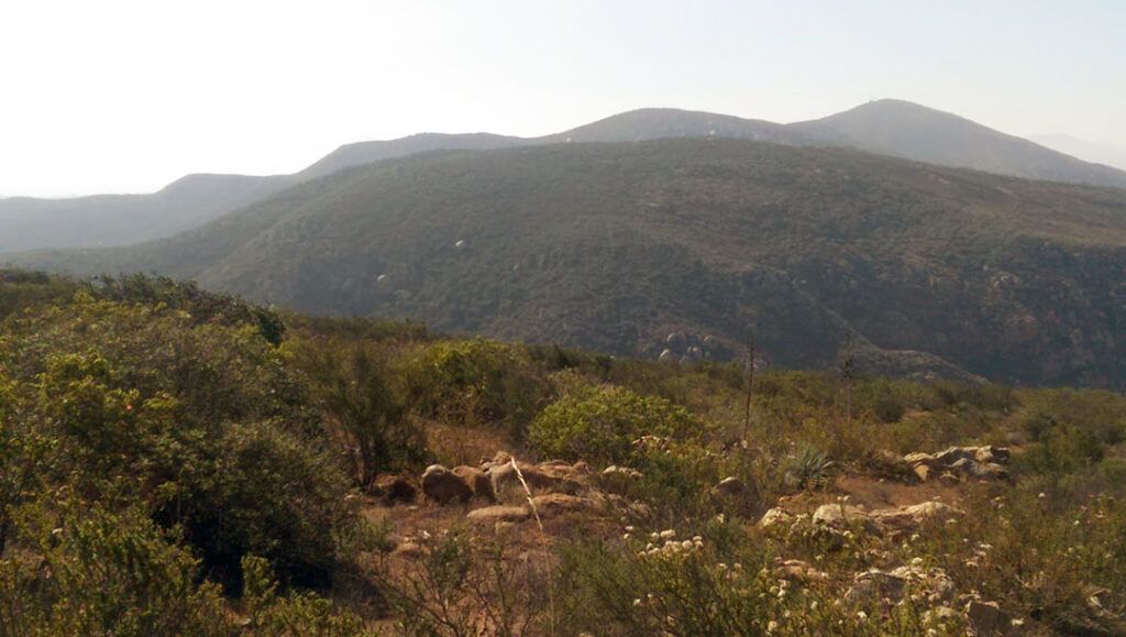
To the South are Kwaay Paay Peak, Pyles Peak, and Cowles Mountain Peak, the highest peak in the city of San Diego. And to the north is your last stop along this journey, North Fortuna Peak.
Your Second Summit: North Fortuna Peak
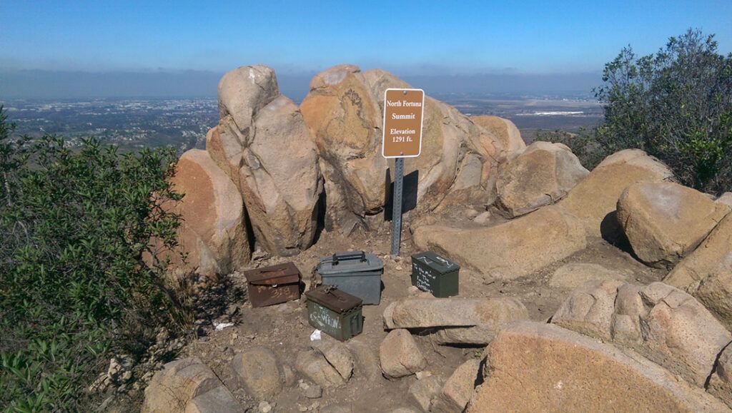
North Fortuna Peak is a short one-mile hike from the south peak. The first peak you reach is a false summit, don’t be fooled by it. Continue along the trail for another couple hundred yards until you reach a summit marker surrounded by ammo cans. Open a can and read through some of the notes left by others who have come before you. Leave a note of your own if you’d like, then give yourself a pat on the back. You’ve conquered two of San Diego’s highest peaks in one day.
The options for getting back to your car are just as plentiful as the options leading to the point where you’re standing. You can head back the way you came, or you can extend the journey, or change the scenery, by continuing along the North Fortuna Trail to the North Perimeter Trail. You also have the option of taking the Fortuna Saddle Trail in either direction.
My Experience Hiking South Fortuna Trail
I loved this hike. We headed out at around 7:30 on a warm Friday morning in July, which was the perfect time for this hike. It didn’t start getting hot until after we had summited both peaks and headed back down the mountain.
The views of the park and surrounding mountains while hiking are constantly changing, almost as much as the terrain and plant life along the trail. The trail winds up and down across hills and valleys giving you a good mix of challenging hills and relaxing nature hikes. And once you reach the summit, you can’t help but be amazed by the views in any direction you look. Of particular note are the three southern peaks of the park standing tall in the distance, encouraging the adventurous to continue the journey.