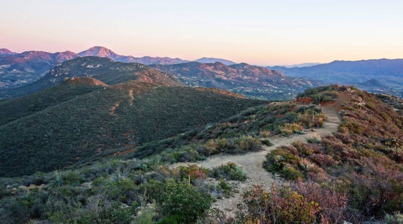
McGinty Mountain Trail in San Diego’s National Wildlife Refuge
McGinty Mountain is Located in the sprawling 12,000+ acre expanse of the San Diego National Wildlife Refuge. Although its 2,183-foot summit may not compete with other regional summits, the views from its pinnacle are truly spectacular.
RELATED: Gaskill Peak: Off-trail Adventures in San Diego's Backcountry
Trailhead Information and Facilities
Situated within the San Diego National Wildlife Refuge, this hiking trail requires no permit or pass for access. Convenient parking near the trailhead ensures easy refuge entry. Keep in mind that no facilities are available on this hike, so plan accordingly.
About McGinty Mountain
McGinty Mountain challenges hikers with a demanding 5-mile round-trip out-and-back trail boasting a 1,480-foot elevation gain. This hike tests your mettle, but the rewards are well worth the effort.
The trail treats you to an ever-changing landscape, winding through diverse vegetation, including some of the county’s rarest plant species. Tecate Peak, San Miguel Mountain, Cowles Mountain, and, on a clear day, the glistening Pacific Ocean are all visible as you make your ascent.
This is a dog-friendly hike, so feel free to bring your furry companion. Just remember to keep them leashed at all times. While open year-round, the best time to hike this trail is from late fall through spring to avoid the heat of summer.
Hiking McGinty Mountain
The trail to the summit is easy to follow. It’s formed through a series of easements, so stick to the widest sections to avoid private property and protect the habitat. For the best experience, remember to pack essentials like sunscreen, ample water, and sturdy footwear. The challenging terrain demands extra caution, so watch your step as you navigate the rocky paths.
What to Expect on McGinty Mountain
The McGinty Mountain trail takes you through diverse landscapes, featuring rugged terrain, steep inclines, and rocky patches that will test your hiking skills. However, you’ll be rewarded along the way with sightings of beautiful, rare plant species, sweeping views, and the potential for wildlife encounters.
McGinty Mountain offers an exhilarating hiking experience in the heart of the San Diego National Wildlife Refuge. It’s a trail that will challenge, inspire, and leave you with cherished memories of a day well spent in the great outdoors.
When to Go
- Spring
- Summer
- Winter
What to Bring & Wear
- Sunscreen & hat
- At least one liter of water
- Hiking shoes or boots with plenty of traction
