North Fortuna Peak via South Fortuna Trail in Mission Trails
San Diego, CA is a haven for outdoor enthusiasts, and Mission Trails Regional Park is a testament to this. Within this sprawling park lie five of the highest peaks in San Diego, each offering its unique adventure. Among the five peaks, North Fortuna Peak, standing tall at 1,291 feet, beckons hikers seeking a challenging yet rewarding experience. Just a stone’s throw away, South Fortuna Peak (1,094 ft.) provides an equally exhilarating journey. The hike to North Fortuna Peak via the South Fortuna Trail is a 6.5-mile out-and-back trek with unforgettable views offering a taste of California’s outdoors.
RELATED: Kwaay Paay Peak Hike from the Old Dam Trailhead
Trailhead Information and Facilities
Accessing the South Fortuna Trailhead is a breeze, with various entry points scattered throughout Mission Trails Regional Park. For this particular adventure, the trail starts right where the San Diego River Crossing Trail concludes. Located southwest of the Mission Trails Visitors Center off Mission Gorge Road, the San Diego River Crossing trailhead parking lot offers ample parking, ensuring a hassle-free beginning to your expedition. No permits or passes are required. While the trailhead lacks facilities, you’ll find convenient amenities at the nearby Visitors Center.
About the Trail to North Fortuna Peak
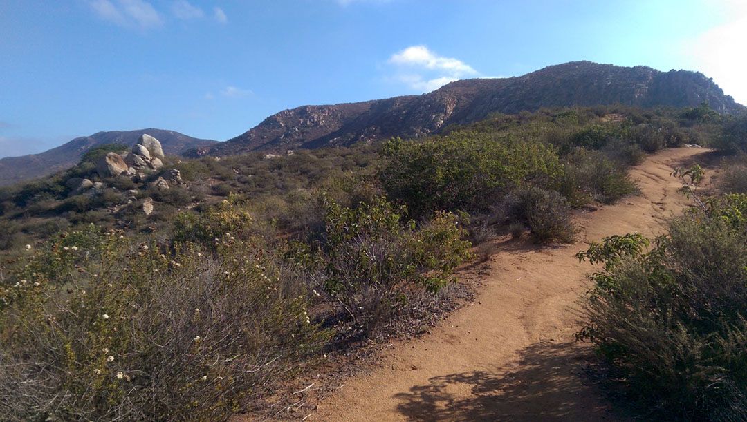
The South Fortuna Trail boasts a diverse landscape with rolling terrain that guides you through captivating scenery. Towering chaparral and fragrant coastal sage envelop the trail, creating a uniquely Californian sensory experience. Rated as ‘challenging,’ the South Fortuna Mountain trail hike offers a satisfying endeavor for those seeking a bit of exertion. Suitable for various fitness levels, allow yourself approximately 4.5 hours to complete the 6.5-mile round trip hike, factoring in breaks and time to soak in the stunning views. Leashed dogs are welcome to accompany you on this hike, so feel free to bring your furry friend along.
Hiking the South Fortuna Trail to North Fortuna Peak
The trail leads you through a well-marked path, with occasional signs guiding you as you hike. Keep an eye out for intersections, staying on course by following the South Fortuna Trail markers. Soon, you’ll reach the stairs leading to South Fortuna Peak. From the summit, it’s a short hike to reach the turnaround point at North Fortuna Peak, where you’ll find panoramic views of the County.
What to Expect on the Hike to North Fortuna Peak
Prepare for a diverse terrain that keeps things interesting throughout the hike. The path is a mix of compacted earth, rocky patches, and gentle inclines, providing the right balance of challenge and accessibility. As with any outdoor adventure, it’s essential to pack water, sunscreen, and sturdy footwear. A hat and sunglasses are also recommended, especially during the warmer months.
As you ascend, take in the sights and sounds of the park’s vibrant ecosystem. Keep an eye out for the occasional glimpse of wildlife, from agile rabbits to majestic birds of prey. The real payoff, however, comes when you reach the summit. A 360-degree view encompassing the entirety of San Diego County, with the imposing figures of Cowles Mountain and Pyles Peak standing tall in the distance, awaits you atop North Fortuna Peak, standing at 1,291 feet.
In all seasons, this trail offers a memorable experience. However, to beat the heat, it’s advisable to embark on this adventure early, especially from late spring through the fall.
The hike to North Fortuna Peak via the South Fortuna Trail is a testament to the outdoor adventures that await you in San Diego. With its accessible trailheads, awe-inspiring vistas, and pet-friendly policy, it’s an experience that caters to all who seek a taste of the outdoors.
When to Go
- Fall
- Spring
- Summer
- Winter
What to Bring & Wear
- At least two liters of water
- Hiking shoes or boots with plenty of traction
- Sunscreen & hat