Los Penasquitos Canyon Trail Waterfall Hike East Approach
Los Penasquitos Canyon Preserve is a nature lover’s paradise in the heart of San Diego. This hidden gem offers an escape into lush wilderness, and the Los Penasquitos Canyon trail is your gateway to a breathtaking seasonal waterfall.
RELATED: Mt Woodson Trail Hike to Potato Chip Rock from Lake Poway
Los Penasquitos Canyon Preserve is easily accessible from major freeways. Home to Los Penasquitos Creek, the preserve offers hikers a chance to escape into nature without leaving the comforts of civilization behind. The Los Penasquitos Canyon trail is a family-friendly hike along a creek that leads to a seasonal waterfall.
Trailhead Information and Facilities
The East Approach trailhead is located off Black Mountain Rd. Parking is abundant, ensuring convenience for visitors from all over. As of August 2023, there is a $3.00 day-use fee at the gate which provides easy access to the preserve via the eastern trailhead. Facilities at the trailhead include restrooms and picnic tables.
About Los Penasquitos Canyon Trail
The Los Penasquitos Canyon Preserve is loaded with natural beauty. California live oaks and sycamore trees form a serene forest canopy. This 6.4-mile out-and-back trail offers a moderate hike with only a 300-foot elevation gain, and leashed dogs are welcome, making this hike family-friendly.
Hiking Los Penasquitos Creek Trail
Starting from the trailhead, follow the path that parallels the year-round stream of Penasquitos Creek. The gentle sound of flowing water will accompany you on this peaceful journey, with charming creek crossings and bridges adding to the trail’s allure.
Most hikers can complete this hike in around 3 hours. Along the way, you’ll enjoy a tranquil atmosphere ideal for birdwatching and reconnecting with nature.
What to Expect on the Trail
Los Penasquitos Creek trail is well-maintained, but comfortable hiking shoes are still recommended. The trail is relatively flat with gentle inclines, making it suitable for families and casual hikers.
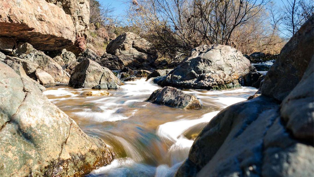
The year-round stream provides a soothing backdrop as you wander through the preserve. And, of course, the highlight of this adventure is the seasonal waterfall, located just over 3 miles from the trailhead. It’s the perfect spot to pause, enjoy a picnic lunch, and snap some photos.
Los Penasquitos Canyon Preserve offers a remarkable natural escape in San Diego’s backyard. This family-friendly hike is a great way to experience the beauty of this preserve, and the seasonal waterfall is the icing on the cake.
When to Go
- Fall
- Spring
- Summer
- Winter
What to Bring & Wear
- At least one liter of water
- Sunscreen & hat