Lawson Peak Trail in Cleveland National Forest
Nestled within the heart of San Diego, Lawson Peak Trail offers an outdoor adventure that promises to leave you breathless – both from the challenging ascent and the rewarding views. This is a challenging hike through the rugged terrain of Cleveland National Forest that requires an adventurous soul.
RELATED: Lawson Peak Trail: Hiking, Scrambling and Climbing to the Summit
Trailhead Information and Facilities
The trailhead stands at mile marker 13 on Lyon’s Valley Road, roughly an hour east of Downtown San Diego. Roadside parking is limited, but you’re not likely to run into many other visitors to the trail. Remember to pick up an Adventure Pass if you don’t already have one. They are required to park in most areas of Cleveland National Forest. It’s a small price to pay for the incredible experience that lies ahead. While facilities aren’t available on this hike, nature is your playground, and the lack of amenities adds to the rugged charm.
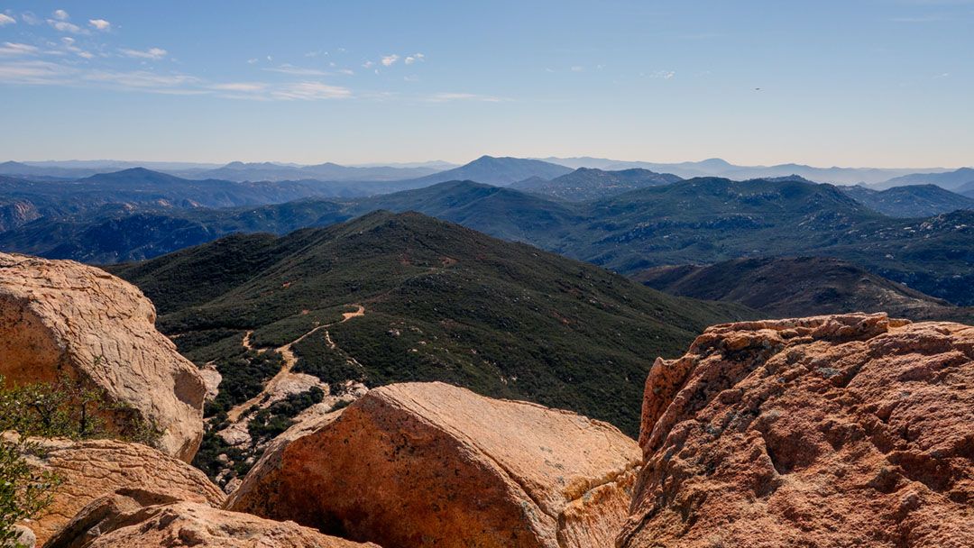
About Lawson Peak Trail
This trail beckons with a promise of challenge and reward. The hike transforms from a fire road into a scramble as you ascend toward the summit of Lawson Peak. A 4.5-mile round-trip, out-and-back adventure, this hike demands about 3 hours of your time. With an elevation gain of 1648 feet and a peak elevation of 3,617 feet, it’s both a test of physical prowess and determination.
The trail’s difficulty level is, perhaps, aptly labeled as challenging. Depending on your rock climbing skills, it may be better to call the final climb ‘difficult.’ If you plan on bringing your dog along for the adventure, keep in mind that it will not be able to complete the final ascent, so plan accordingly. The best time to tackle Lawson Peak Trail is from late fall through spring when it’s cooler. Spring is also a great time to enjoy our local wildflowers in bloom.
Hiking Lawson Peak Trail
Your journey begins on a fire road, a mere prelude to the excitement ahead. The path transforms into an exhilarating scramble toward the peak, infusing each step with adrenaline. Every effort is worthwhile. For those hungry for added adventure, consider expanding your day hike another 2.6 miles to include Gaskill Peak. This bonus escapade grants you access to all that Lawson Peak Trail offers and an additional rocky summit to scramble.
What to Expect on Lawson Peak Trail
Prepare to be amazed by the ever-changing terrain, from rocky outcrops to lush stretches of greenery. 360-degree views that stretch from the Eastern San Diego Mountains to the glistening Pacific Ocean await you at the top. But remember, challenges are part of the deal. Wear comfortable hiking shoes with plenty of treads, pack enough water, and don’t forget sunscreen.
As you traverse, keep watch for the local wildlife and unique plant life that calls this landscape home. Lawson Peak Trail offers a thrilling escape and a chance to conquer a peak and claim the reward of panoramic views that will stay etched in your memory.
When to Go
- Fall
- Spring
- Winter
What to Bring & Wear
- Plenty of water
- Adventure Pass is required in most areas around Cleveland National Forest
- Gloves
- Hiking shoes or boots with plenty of traction